This boulder carved a satisfying track as it slid downhill, and you can see it with lidar imagery
by Philip S. Prince
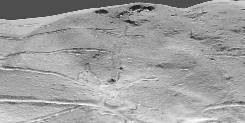
A few weeks ago, after years of “lidar surfing,” I finally encountered an Appalachian boulder that left clear evidence of its sliding path down a mountainside. Large boulders are common throughout all of topographically rugged Appalachia, but they typically reveal little or no evidence about their paths from upslope sources to their current resting places. This Macon County, North Carolina, boulder is a rare exception, as it carved a distinct groove or track on the land surface that can be followed from cliffs upslope to the boulder’s current position.
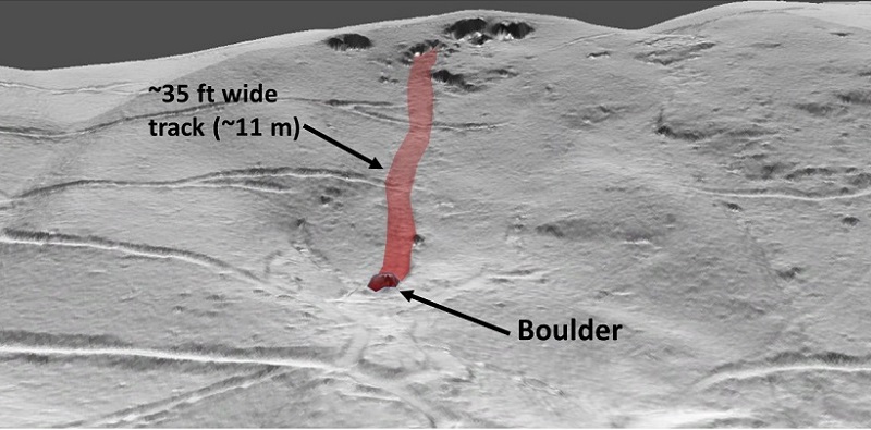
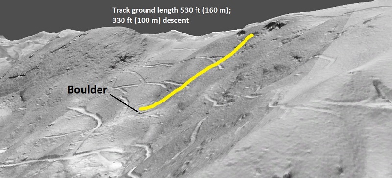
The boulder is about 10 meters (33 ft) wide at its widest. Its thickness is unknown, but it is likely several meters thick, and is sufficiently large to “stick up” in the 3-D Arc Pro GIF below.
Like so many Appalachian slope failures, the age of this “boulder slide” is unknown. Logging roads that are likely several decades old cut across the track, and no disruption to trees is apparent in aerial photography, so the event is presumably at least ~100 years old. Given the lack of similar tracks on other boulders in the region, these features clearly don’t last forever. This one is likely “young” in the overall context of processes that alter visible details of the ground surface and soil profile in this humid-temperate region.
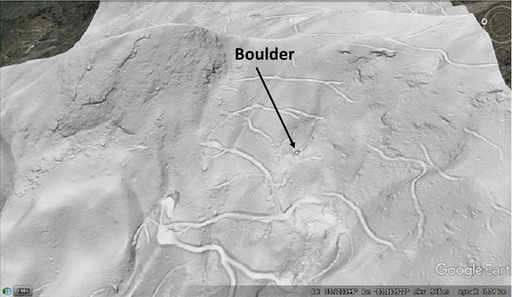
A particularly interesting detail of the boulder and its trip downslope is the pile of “plowed” soil visible at the boulder’s leading edge. The lidar signature of the soil pile suggests it is at least 1 meter (3.3 ft) high.
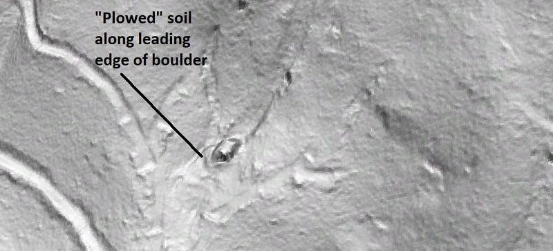
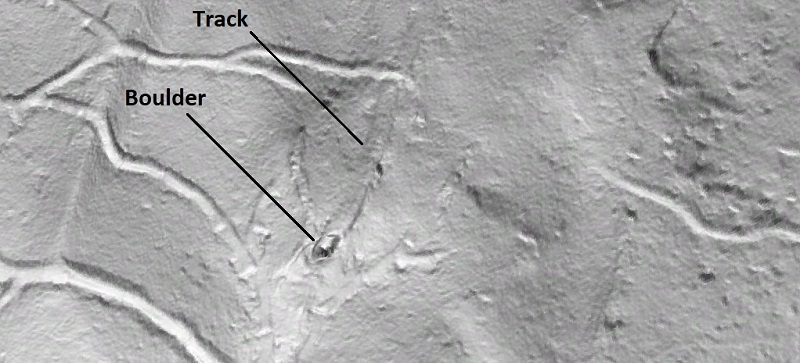
The “plow-pile” at the tip of the boulder remains visible even in a very close zoom. Several graded areas are visible near the boulder; they presumably relate to logging operations. Fortunately, they stayed far enough away to avoid disturbing the plow-pile.
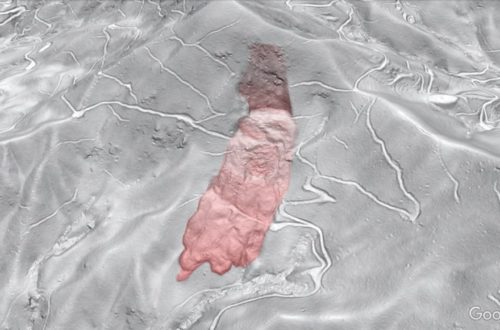
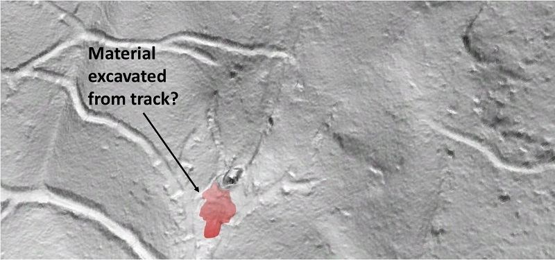
The length and width of the track indicate that a large amount of material was pushed out of the way by the sliding boulder. Some of it is visible piled along the edges of the track, but additional material was likely driven ahead of the sliding boulder, which may have moved during very wet conditions. Lidar suggests significant excavated material may be present just downslope of the boulder, but field verification of this idea is needed. The red polygon in the image below suggests where this excavated soil may have been deposited. This image also shows the track nicely.
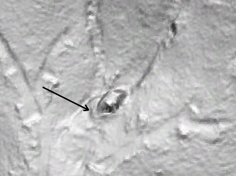
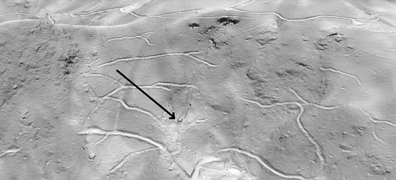
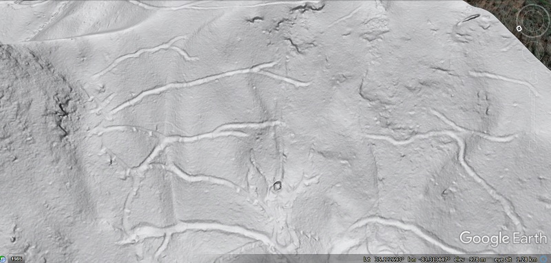
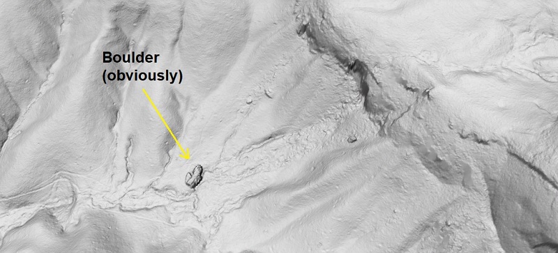
While the boulder would be very impressive in person, it is a tiny feature on the mountainside as a whole. The boulder initially caught my attention due to its bold outline, and the track only became noticeable after zooming in. The black arrow in the first image below points out the boulder. The track is faintly visible once you know it’s there, but it isn’t exactly eye-catching. The second image is from a slightly different vantage point in a kmz file, and the boulder isn’t labeled (do you see it?). On some screens, I think the boulder and track look better in the first ArcPro image; on others, I find it more visible in the kmz.
The boulder descended about 100 m (330 ft) in 160 m (530 ft) of ground-length travel. Based on the appearance of the track, I presume it slid the whole way, and probably detached from a downslope-dipping outcrop to start its journey in a favorable orientation.
In addition to just being interesting to look at, this boulder and its journey are worth considering from the standpoint of human-landscape interaction. People live on these slopes, and the GIF below shows that a house is situated directly downslope from the boulder. The boulder came to rest where the steepness of the slope locally decreases, and its sliding style of travel probably caused it to stop as soon as the necessary steepness was lost. A tumbling and bouncing boulder probably would traveled farther, and a few noticeable boulders are certainly downslope of the house, though none of them show any indication of how they got there. Understanding how details of topography, along with movement style (tumbling vs. sliding), can alter the downslope travel of large rocks is worthwhile information in inhabited mountainous areas. Lidar imagery is critical to learning more about these processes.
So, are there other examples of this? I have written about a few other lidar features that suggest details of boulder and rockfall travel, and I have seen one small boulder in the field which had recently rolled into place and left interesting marks in the soil and on trees upslope. While boulders are everywhere in the rugged portions of Appalachia, traces of their movement appear to be eliminated by erosion and vegetation cycles MUCH more quickly than the boulders themselves weather away. Plenty of additional examples surely exist, but the intensity of lidar inspection necessary to find them would likely cause blindness or some other negative side effect, so I don’t plan to begin a boulder track search anytime soon. The only other boulder I know of that might show a track is in Transylvania County, North Carolilna, near Johns Rock. It is massively huge–about 40 m (132 ft) long, and probably 15 m (~50 ft) thick–and it surely slid from the obvious dark scar on the cliff line up and right of its present resting place.
The land surface is rough and irregular between the boulder and its source, which might suggest lasting disturbance from the initial failure and sliding event. This texture could result from water erosion and accumulation of smaller rock fragments from the scar. Like the Macon County example, the entire area is thickly re-vegetated. Field work might help sort things out, but, as in so many other cases, high-resolution lidar imagery might be the best source of information.