Pleistocene Coastal Plain sand dunes and the value of pattern recognition in LiDAR interpretation
by Philip S. Prince
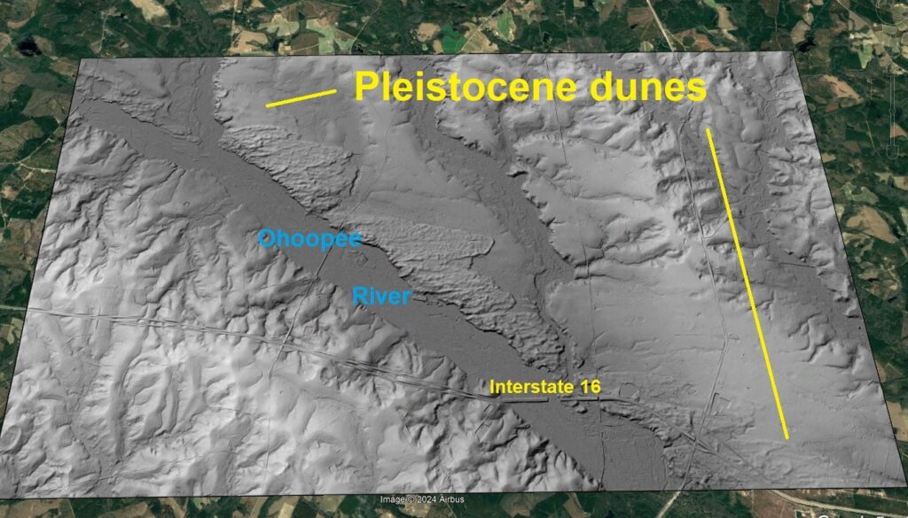
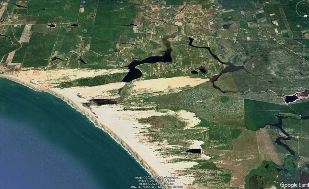
Pleistocene-aged sand dunes are some of the most conspicuous lidar features of the southeastern United States Coastal Plain, largely because their lumpy surfaces and non-erosional outlines contrast sharply with other “background” landforms. It’s hard to imagine the modern-day swampy Coastal Plain being much less forested and windy enough to be covered with migrating sand dunes, but high-resolution lidar imagery shows just how widespread these features once were. A particularly beautiful set of dunes is visible with lidar imagery on the east bank of the Ohoopee River west of Metter, Georgia, just north of Interstate 16.
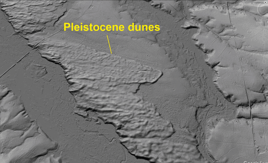
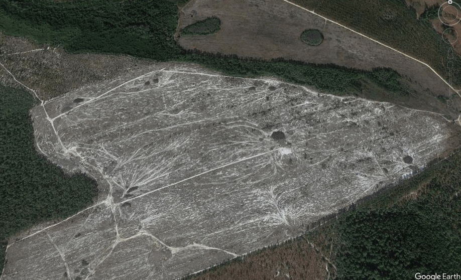
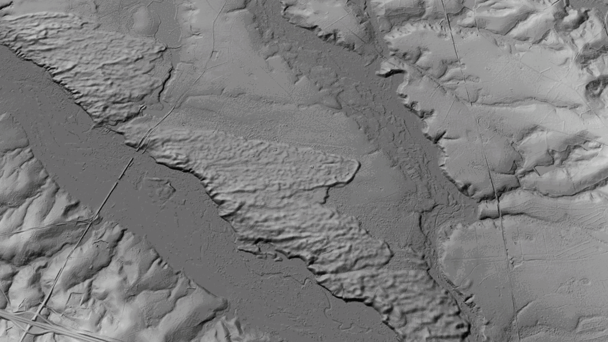
Wind direction was from left to right (west to east), and the sand in the dunes was derived from sandy coastal plain sediments exposed in the bluff carved by the Ohoopee River. Dunes like these are interesting landforms to examine with lidar because their shape implies the material movement that formed them–it’s easy enough to imagine wind sweeping the sand across the landscape. An intersting detail of these ancient dunes is how their sandy soil controls agriculture. Note how the bright, sandy soil is visible in places where farmed trees have been harvested in the image above. I’m not exactly sure why, but tree farming closely follows the boundaries of the old dunes very closely, as seen below.
Looking for features like these dunes is a good way to train for pattern recognition in lidar evaluation, as the dunes are not as conspicuous when the observer is “zoomed out.” Once identified, however, the dunes are quite distinct from background erosional features (stream channels, etc.) and are consistent in their appearance within the region.
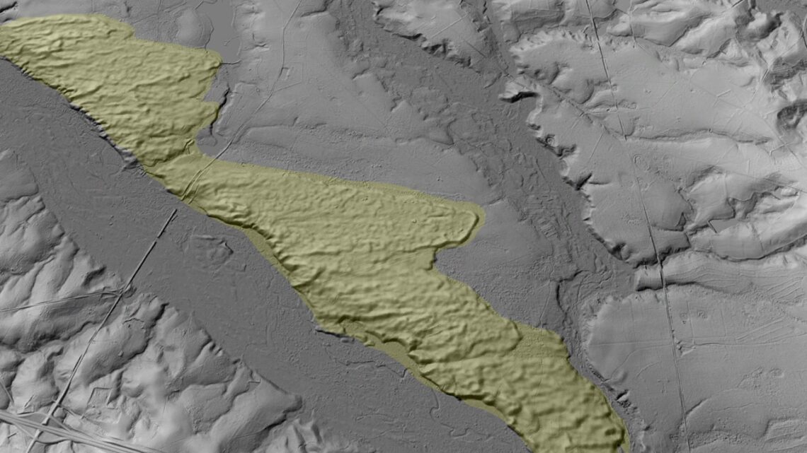
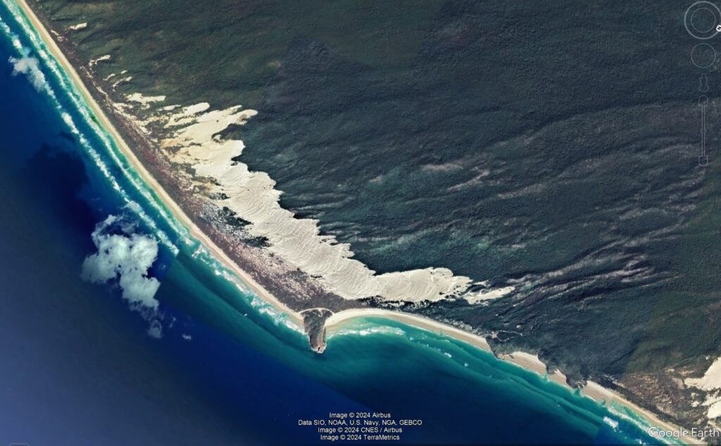
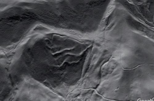
Interpreting landforms like the dunes with lidar imagery also requires understanding of modern-day, active features whose origin and evolution is known. There are plenty of modern dune features to see in Google Earth, and (unsurprisingly) they bear a striking resemblance to the Pleistocene Ohoopee dunes. The dunes shown below are a nice example; they have developed above a river bluff in northern Alaska.
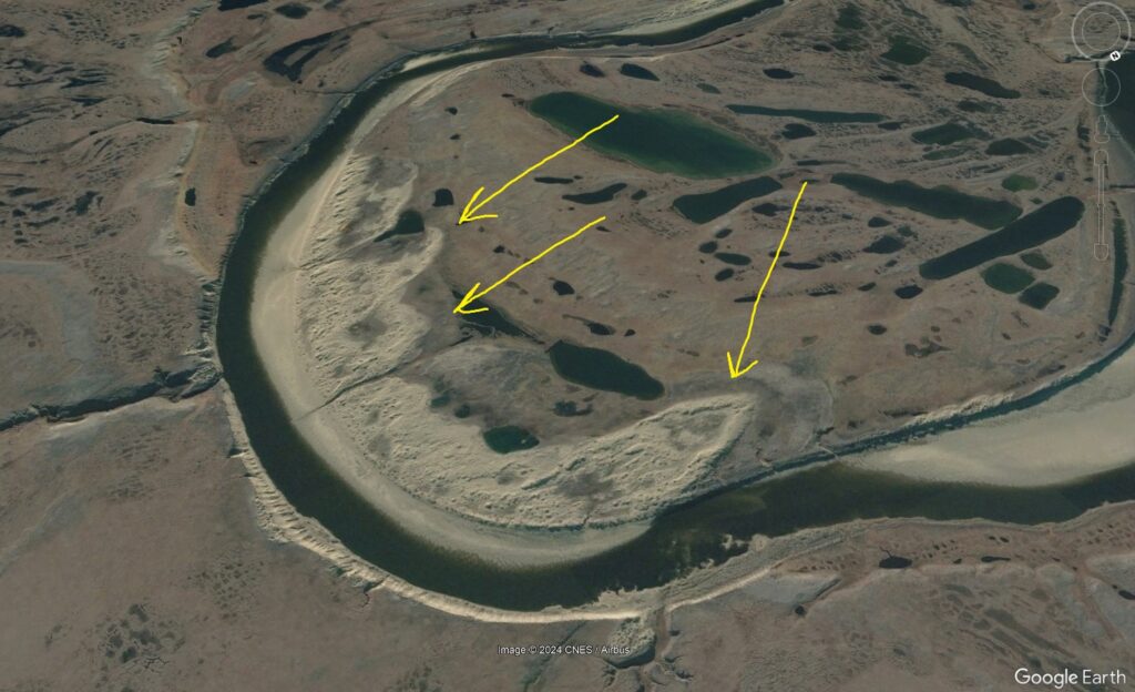
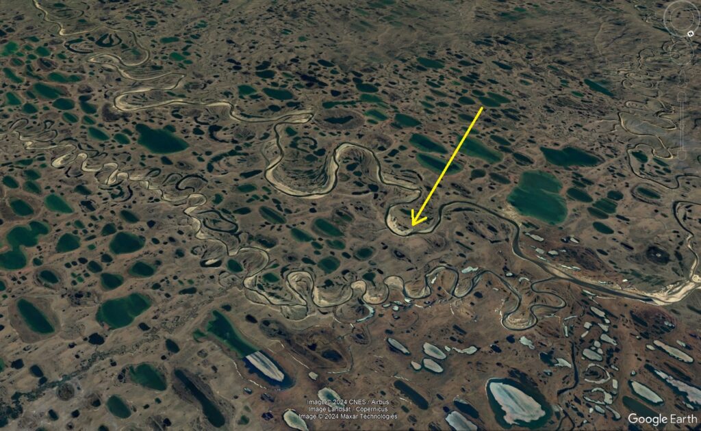
Interestingly, modern-day northern Alaska has been suggested as a good indicator of what the Pleistocene Coastal Plain landscape was like. These Alaska dunes are located in a landscape full of elliptical, wind-sculpted lakes that are a dead ringer for Carolina Bays as well. Carolina Bays and modern-day landscape comparisons need their own post, but the similarities between these Alaskan features and many aspects of the southern Coastal Plain landscape are almost uncanny. In the image below, the yellow arrow points to the river bluff dunes shown above. The swarms of elliptical lakes are obvious enough. Lakes near the lower right edge of the image are partially covered in ice.
Dune development is a product of the laws of physics and the materials involved, not latitude or geography, and good examples along topographic bluffs can be found throughout the modern world. The coast of central Brazil has some outstanding dune fields that are useful in identifying and interpreting old, vegetated features like the Ohoopee dunes.
The island of K’gari in Queensland, Australia, is another good example.
The consistency of dune shape between all of these locations is a nice example of patterns and their recognition in the Earth system. By thinking about landforms as expressions of a given process, anyone interested in geology can work logically towards understanding why a particular location looks like it does. Pattern recognition is a good way to link the study of older, sometimes partially preserved landforms with the modern landscape to allow accurate interpretation of features that might otherwise be mystifying. After looking at the images in this post, some landforms in the lidar image below might be more recognizable.
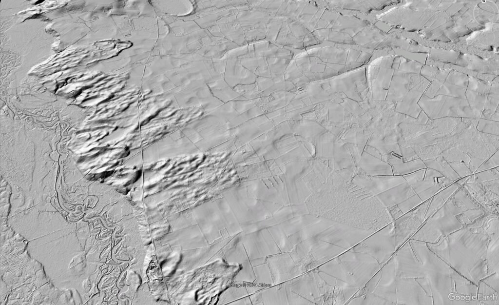
This image is from Lee County, South Carolina, just north of Lee State Park. The Lynches River (left side of the image) carved bluffs into sandy Coastal Plain sediments, which provided a sand source for Pleistocene winds. These dune features are analogous to the Ohoopee River dunes, which are quite far away but located in a comparable geologic setting under the same Pleistocene climate regime. An observer need not be an expert in South Carolina geology to interpret this lidar image; understanding material movement and dune development in the Earth system is far more useful.
A closer look at the Lee County image reveals hundreds of small, elliptical, and very faint “pock marks,” with a few larger ones mixed in. These are Carolina Bays, which remain “officially” unexplained. Take a look back at the second Alaska image and see what you think in terms of pattern recognition…


You May Also Like
Lidar highlights impressive landslide density on the southern Appalachian Blue Ridge Escarpment, western North Carolina
LiDAR reveals the cloth-like appearance of a “wrinkled” translational landslide