Moving mountainsides: The giant quartzite landslides of the Macks Mountain area of the Virginia Blue Ridge
by Philip S. Prince
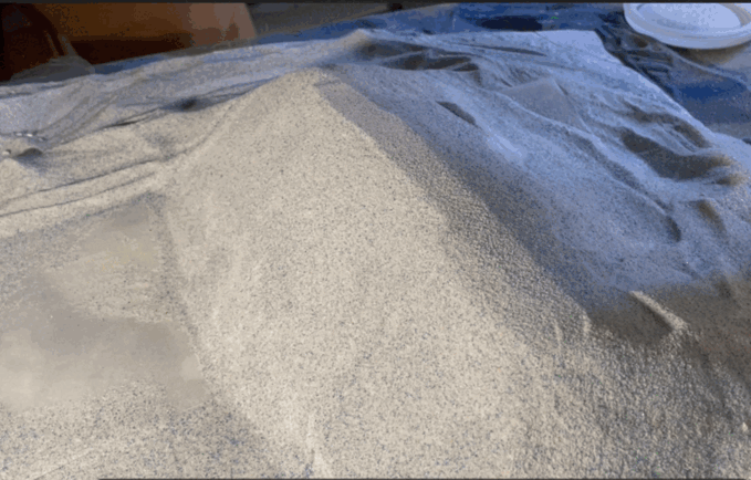
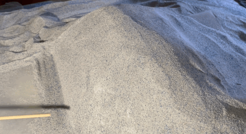
Landslides can be triggered by a variety of conditions or events. Erosional removal of the base, or toe, of a steep slope is a common cause of landsliding, sometimes creating “stop and go” landslides that move episodically when erosion carries away just enough material to create instability. After a bit of slide movement restores the shape of the slope toe, movement stops until enough material is eroded again. The model below shows what this process looks like. Scraping a tiny bit of material from the base of the slope causes an equally tiny movement of the slope. Continual scraping away of material causes the effects of small movements to add up, gradually producing a large and impressively cracked and fractured landslide mass.
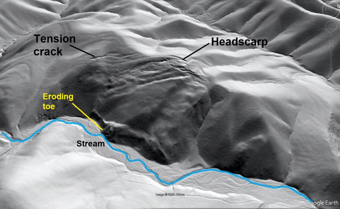
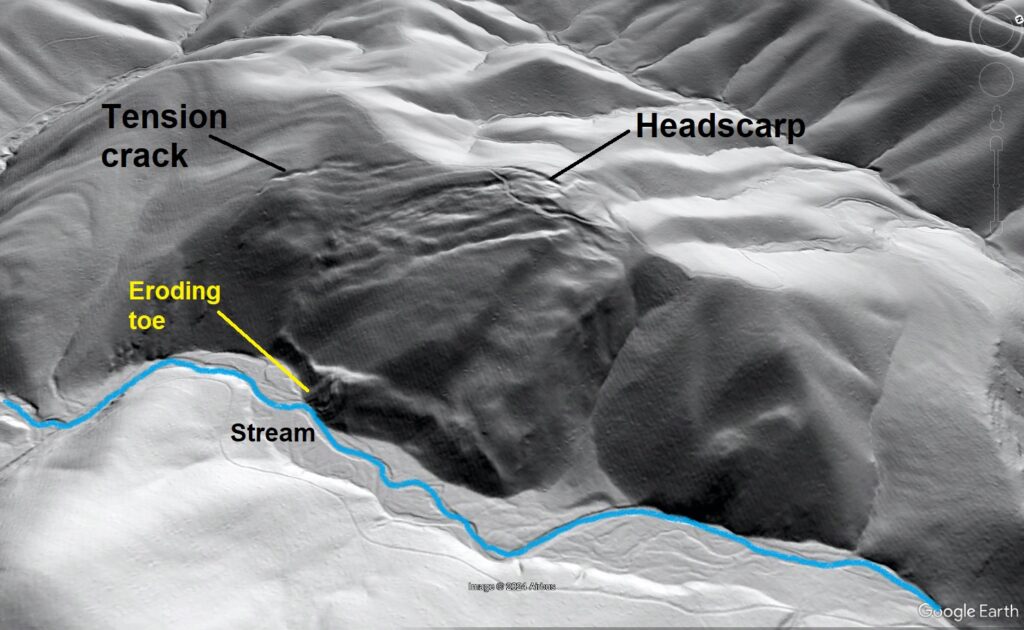
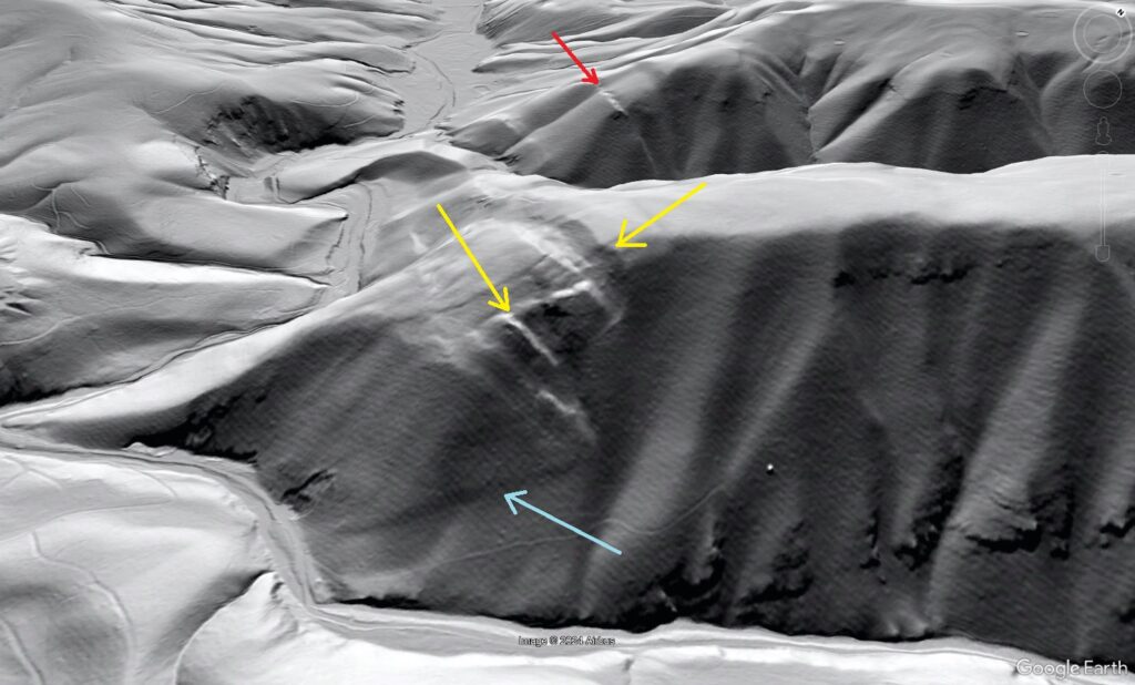
Some interesting real-world slides that appear to result from this type of ongoing erosional toe removal are found in the Macks Mountain area in the Blue Ridge of southwest Virginia (map at the end of this post). The lidar image below shows one such slide, whose appearance can be matched to the later stages of movement of the model shown above. Cracks and fissures extending from the top of the ridge are clearly visible, as is the steep, eroded toe along the stream. The slide is 2,000 ft (600 m) wide. The top of the ridge and head of the slide are about 600 ft (180 m) above the stream below.
The cracks and fissures at the head of the slide along the ridge crest stand out against the normally eroding parts of the surrounding landscape. The unusually steep eroded toe of the slide, which is in deep shadow in this hillshade image, also contrasts with the even the steepest streambanks in areas unaffected by sliding. At the left side of the image, faint bedrock ribs can be seen on the land surface. These bedrock ribs indicate that layering tilts down towards the stream, favoring sliding.
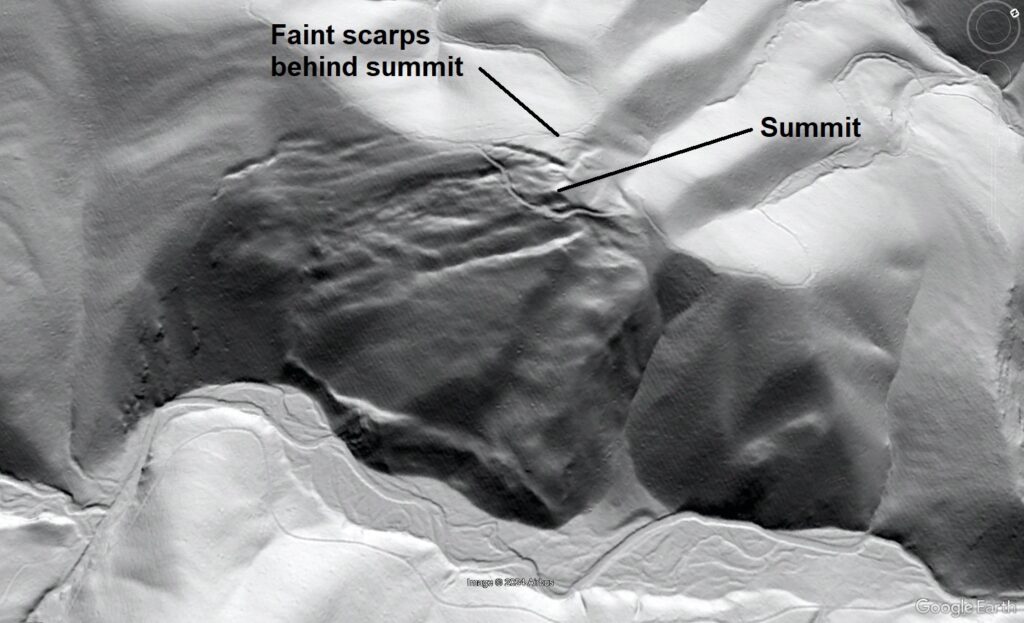
A particularly interesting detail of this slide is the presence of faint scarps or tension cracks behind the summit of the ridge with respect to the stream at the toe. In other words, the actual summit of the ridge is within the slide mass and has lowered and moved downslope just a bit. This arrangement of slide features with respect to the shape of the slope indicates that the slide is thick and is moving on a weak layer or layers deep beneath the surface of the slope.
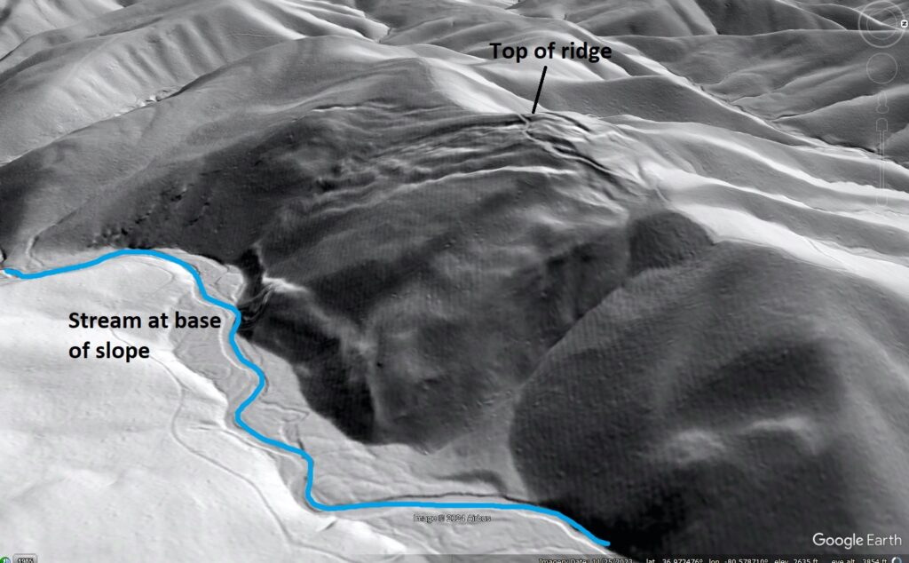
The geology of the Macks Mountain area sets the stage for numerous huge slope movements like the one shown above. Macks Mountain features rugged topography due to the presence of folded and faulted quartzite bedrock, which is quite hard and resistant to erosion, alongside weaker layers of mica-rich slate or phyllite bedrock. Slate or phyllite cannot support the slope steepness that develops due to the “armoring” effect of quartzite layers, leading to big landslides that slowly feed rock into the eroding streams below. Lidar imagery makes the slides easy to see, but their size and subtlety would make them less than obvious to a ground observer. The example shown below features the characteristics seen in the previous slide.
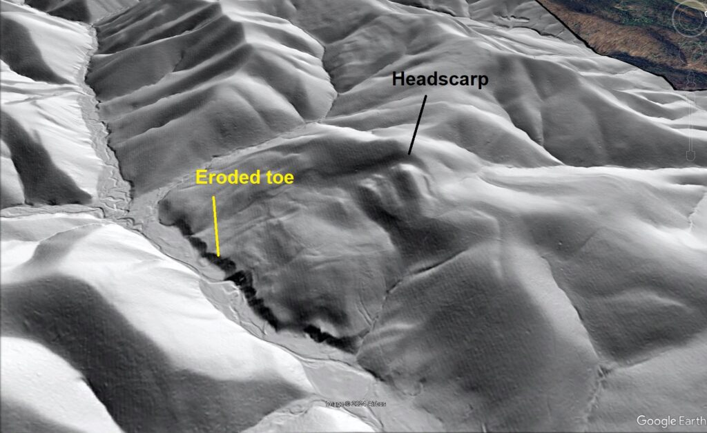
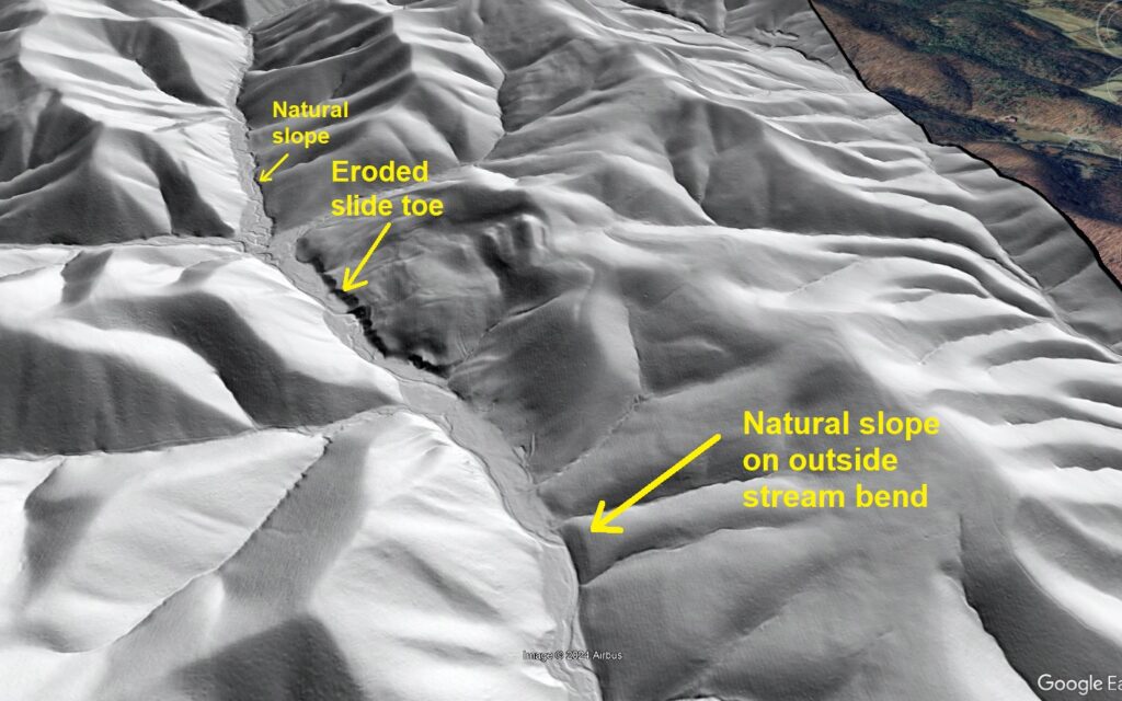
This slide is a bit less crisp and sharp, suggesting it might be a bit older or be in a longer period of suspended movement. Even so, the steep, eroded toe and blocky, lumpy topography below the headscarp contrast nicely with the surrounding erosional topography. The eroded toe area is particularly distinct, and is notably different from even the steepest streambanks in areas not affected by sliding, as seen below. This toe steepness suggests some slide movement is recent enough that the toe has not yet returned to an appearance more like the undisturbed landscape.
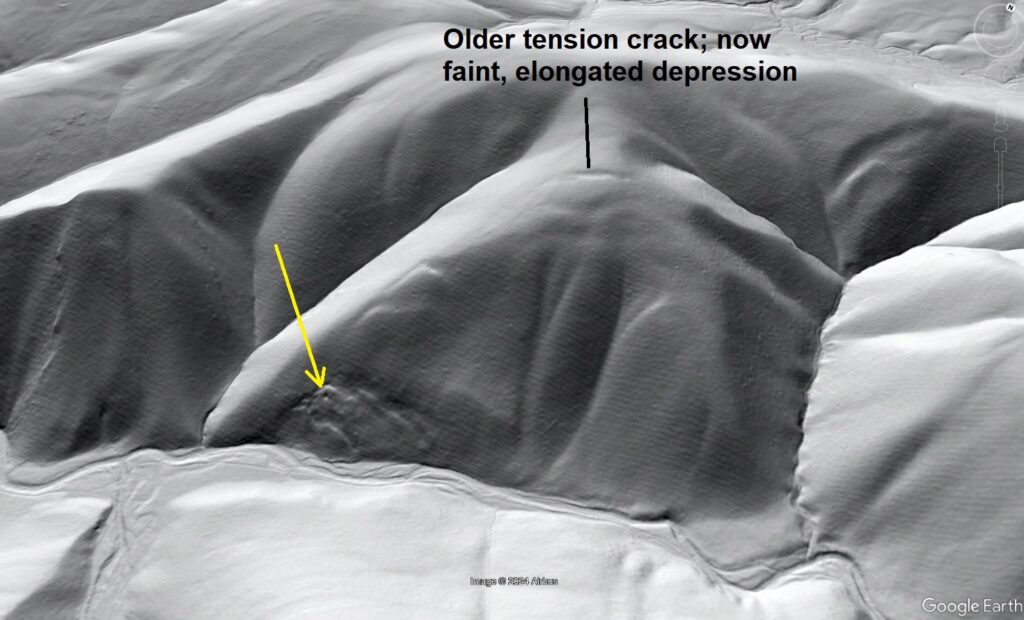
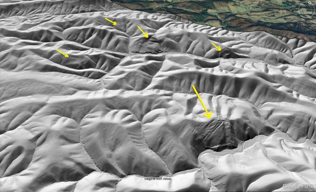
Bedrock-involved landslides like these come in a variety of sizes in the Macks Mountain area. Some smaller slides appear to have destabilized larger areas of the slope, possibly setting the stage for future movement of larger areas. The small slides indicated by yellow arrows below are about 1/4 the size of the first slide in the post, but they have developed for the same geologic reasons.
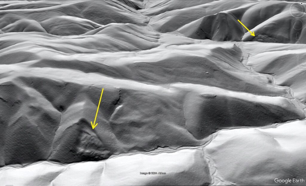
The slide in the background of the image above appears related to older tension cracks well upslope of the crisply defined slides. Now a faint, elongated depression, the upper tension crack suggests that a huge portion of the slope once experienced a tiny amount of movement, and might shift again in the future.
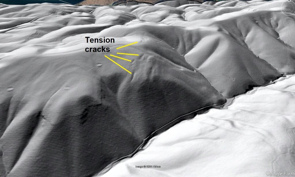
Other old tension crack sets do not have any obvious recent slides associated with them. These cracks also suggest that slopes in the Macks Mountain area exist at the threshold of movement, possibly due to stream incision and relief production associated with the downcutting of the nearby New River. The tension cracks shown below are similar to the example above, though more numerous. A road grade and stream are present at the base of the slope, though no smaller slides are visible. The tension cracks would appear as subtle depressions in the forest today, as soil development has dulled their outlines.
Near this group of old tension cracks, two unusual topographic features are likely the result of the largest and thickest slope movements in the area, although their unusual appearance makes interpretation more difficult. These possible slides are shown below.
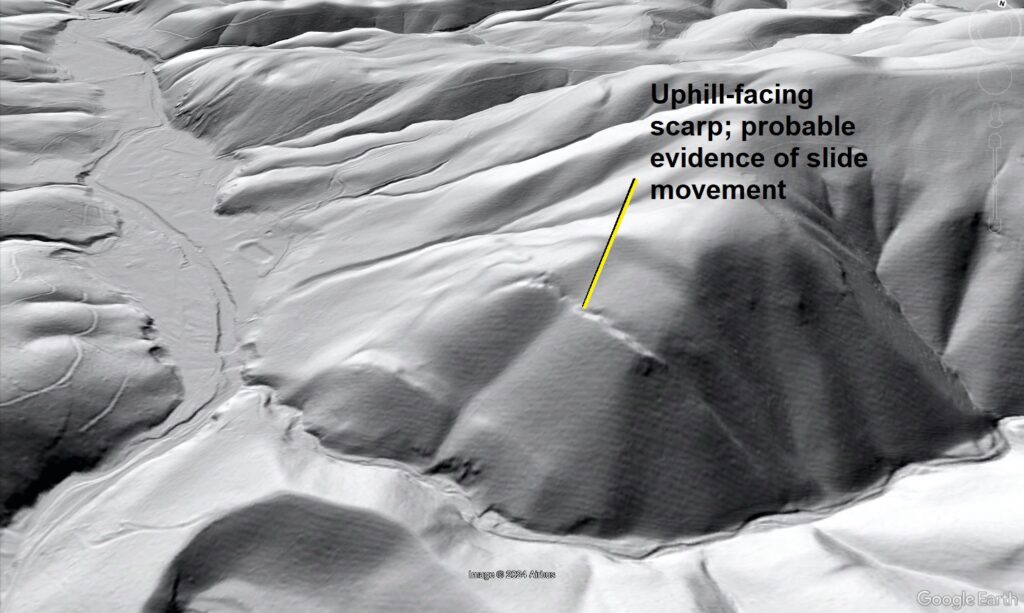
In both images, yellow arrows indicate probable scarps that are significant to a landslide interpretation. In the image above, the light blue arrow shows a likely toe bulge related to faint downslope movement. The red arrow in the background indicates the position of the uphill-facing scarp in the previous image. These features lack the ease of interpretation of the other slides shown, but their features are effectively impossible to explain without slope movement. Uphill-facing scarps and the associated localized surface depressions are very significant. “Typical” sinkholes related to bedrock dissolution do not form in this type of rock, so any surface depression results from a physical gap due to slope movement or excavation by humans. The model below shows uphill-facing scarp development, along with localized sinking of the model surface.
The big “mystery” features do not resemble surface excavation in any way. They are very large, oddly shaped, and have formed in areas with no access roads for the equipment and personnel necessary to remove such large masses of rock. Due to the prevalence of large-scale bedrock landsliding in the area, the “mystery” features can reasonably be interpreted as large slope movements. A zoomed-out view of the surrounding area shows that landslides aren’t hard to find in amongst the ridges of Macks Mountain due to the bedrock character, slope steepness, and likely history of relief production in the area. Yellow arrow point out slides in the image below, which is a nice practice image for pattern recognition in lidar interpretation.
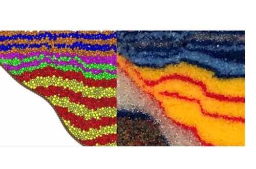
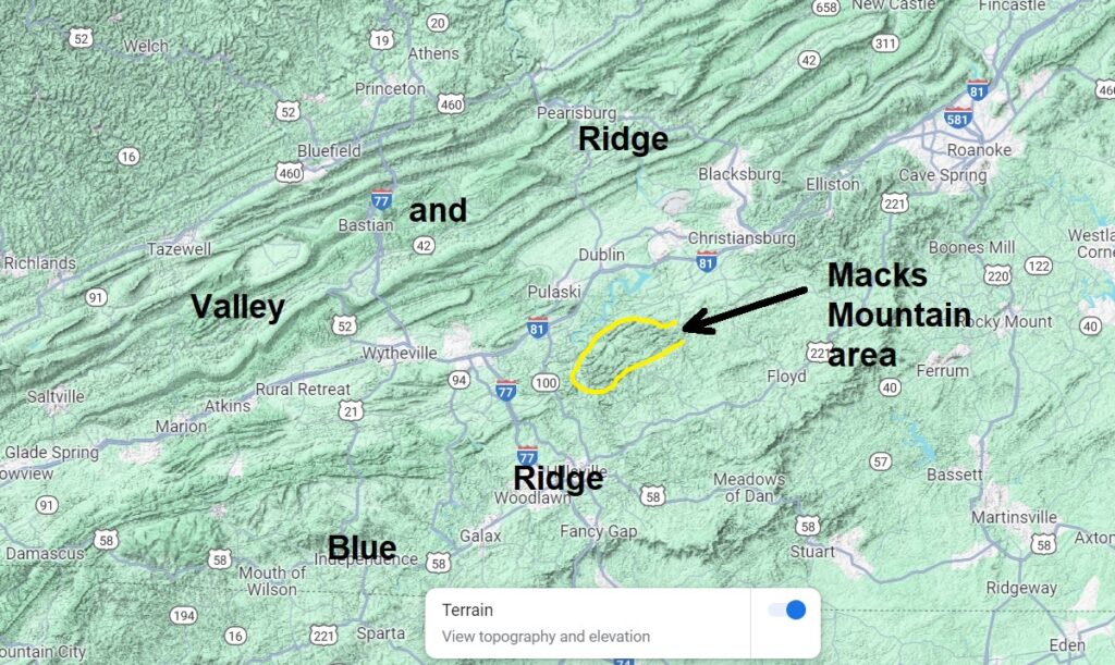
Big bedrock landslides are a common topic on this blog, as they are fundamental feature of many mountain landscapes in southwest Virginia. The most well-known slides occur in the Valley and Ridge, where tilted sandstone layers slide on weak shale layers. Macks Mountain is underlain by metamorphic rocks of the Blue Ridge province, but quartzite and phyllite are just slightly “cooked” sandstone and shale, respectively. Quartzite and phyllite retain the extreme mechanical contrasts of sandstone and shale and behave accordingly in the landscape. The relative locations of the Macks Mountain area and the Valley and Ridge are shown below.
A particularly interesting aspect of Macks Mountain slopes is that none of the slides appear to exhibit large-scale, rapid movement that would be particularly dangerous to people in the area. Topographic evidence suggests the slides just creep along, and may see suspension of movement for very long periods. While they don’t threaten people living nearby, engineering projects would need to avoid the slides. As stream erosion appears to be a driver for their movement, excavation of the toe of slide to build a road or any sort of structure in a stream valley would likely lead to movement. Projects like pipeline construction also need to consider this type of slide, as even slight movement can have catastrophic effects should the movement rupture a pipeline. Fortunately, high-quality lidar imagery makes big landslides like these easy to see in the landscape, supporting good decisions with regard to land use and development.

You May Also Like
Sandbox models with high-displacement thrust faults compared to features of some Canadian Rockies sections
The Ray Sponaugle well: A 13,000 ft lesson in Appalachian Valley and Ridge structure