Another intersection of lidar and 19th-century observations at the Silas McDowell slide, Macon County, North Carolina
by Philip S. Prince
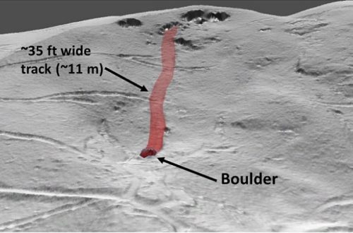
In addition to the Split Mountain slide described in the previous post, Thomas L. Clingman referenced other slope failures known to have occurred in the western North Carolina Blue Ridge during the early to mid-19th century. Geographical descriptions of the slides’ locations vary in quality, but one feature initially reported by Silas McDowell of Macon County proved easy to locate with the aid of lidar-derived slope-shade (an inverted black and white slope raster) imagery. Like the Split Mountain slide, the Macon County feature is entirely re-vegetated and not noticeable without high-resolution, lidar-derived imagery. The slide is shown in the GIF below, and the Google Maps image that follows shows the feature’s location with respect to Franklin, North Carolina.
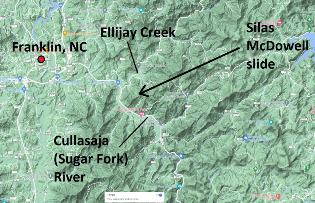
This slide was described as being located on the north slope of the ridge separating Ellijay Creek from the Sugar Fork River (today’s Cullasaja River), and this simple description was adequate to find the feature due to its size, displacement, and surface texture. McDowell described the slide as a “violent shock” which opened a “chasm” that remained visible for many years after the initial event. The date of the slide is unknown, but probably occurred around the 1850s.
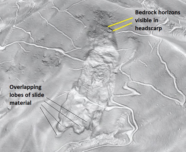
The slide shows a dramatic and steep headscarp, which cuts bedrock horizons. I am unsure of the bedrock lithology, but broad-scale mapping in the area suggests it is likely biotite gneiss. The texture of the slide mass and the lack of an intact slide block is consistent with rapid emplacement with a minor component of flow. The extent of the rupture surface is unclear, but the overlapping lobes of material at the slide toe are probably well downslope of the base of the rupture itself.
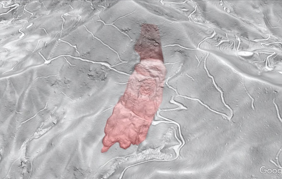
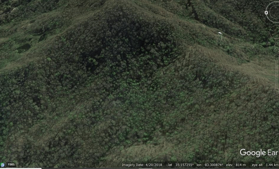
The use of the word “shock” in the description of the Macon County slide shows it refers to the slide event itself and not to seismicity that caused the failure. The preceding slide description in Clingman’s writing supports this idea, as an 1829 slope failure in the Valley River Mountains in Cherokee County is said to have followed an earthquake, which is described as “a shaking of the ground.” I searched for this slide, but I was unable to find anything as obvious or dramatic as the Split Mountain and Silas McDowell features. The only plausible candidate, which is actually located just inside Clay County, is shown below. The Google Maps image shows its location within the Valley River range east-northeast of Murphy, North Carolina.
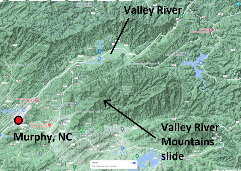
The description of the Valley River Mountains slide as “partially filled in” suggests it was less dramatic in appearance even in Clingman’s day, so perhaps the somewhat muted feature visible today with lidar is indeed the slide in question. Lateral scarps are faintly visible, and more recent activity at the toe of the slide might be evidence of reasonably young age. A presumably older slide is visible to the lower left of the slide mass outlined in the GIF. The appearance and size of this slide suggest it has probably experienced ongoing, episodic movement, so the 1829 failure may have only represented localized movement of a portion of the overall feature.
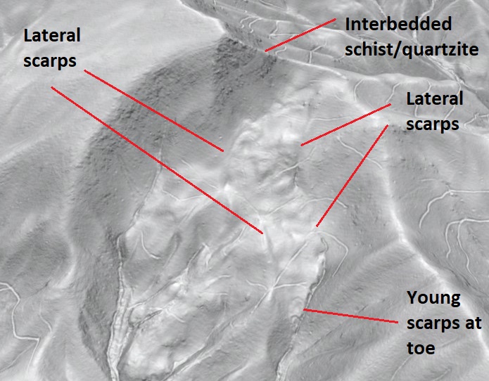
Bedrock horizons (schists and quartzites) visible on the peak above the slide indicate its dip slope context. The extent to which bedrock is involved in the slide (as opposed to overlying colluvium and soil) is unclear. Several other dip slope slides occur in the immediate area, but all appear significantly older.
In addition to providing interesting information on these slope movements, Clingman’s “Volcanic Action in North Carolina” manuscript provides a fascinating look into prevailing ideas about Earth process in the mid to late 19th century. Kathy Ross kindly provided the link to the entire manuscript (click here), which is a quick and worthwhile read.