The waddling boulder…a storm-induced trundle* event?
by Philip S. Prince
*yes, trundle will be defined at the end.
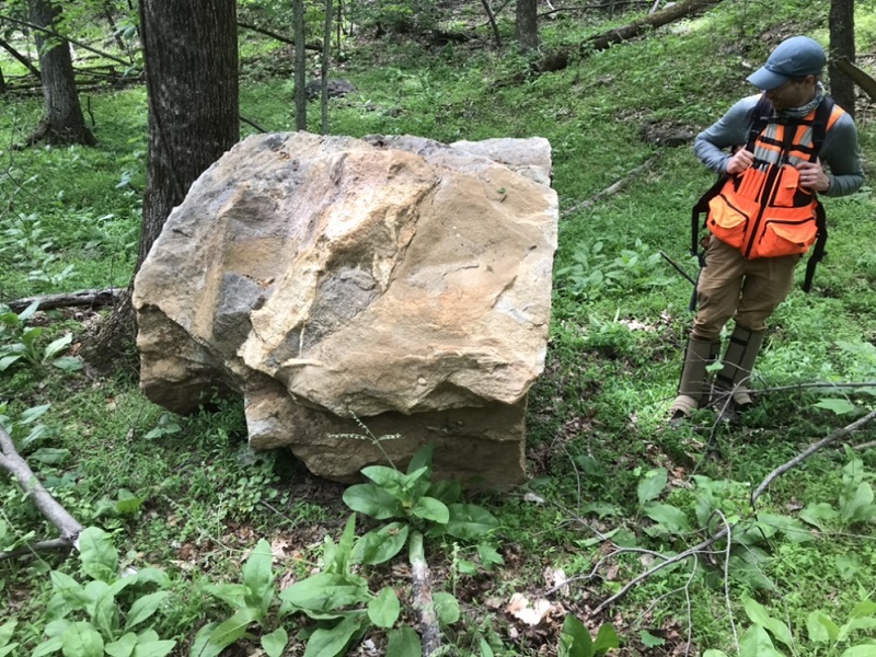
I see lots of boulders in the course of my fieldwork, but this one just looked different…
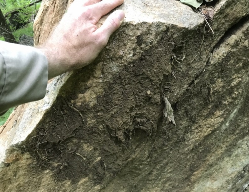
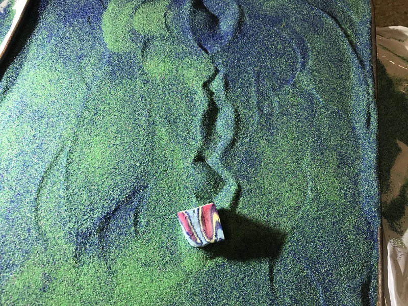
Appalachian Landslide Consultants geologist Aras Mann (pictured above) and I spent a fair amount of time trying to figure out just what made this boulder look so strange. We first noticed its apparently soil-stained color, unusual in its rainy Rutherford County, North Carolina, setting. The boulder also had mud and dead vegetation caked on its corners and edges.
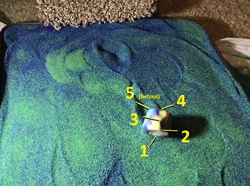
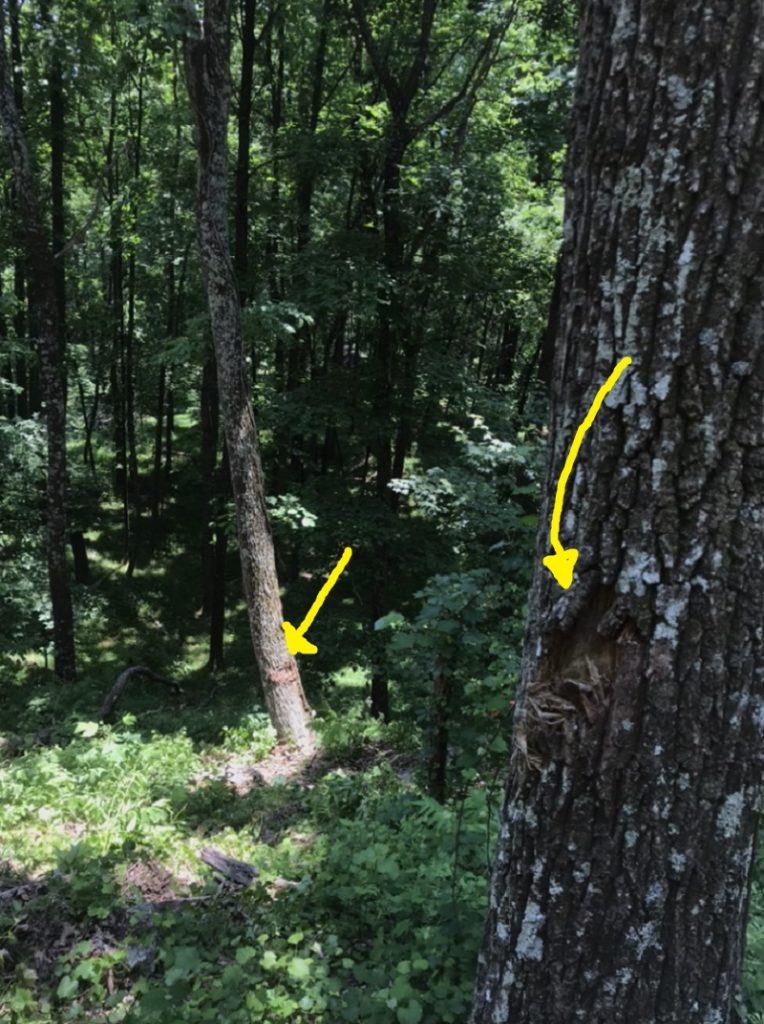
Eventually, we looked towards the slope behind the boulder’s resting place and noticed two flattened saplings and alternating, diagonal gouges in the soil (yellow arrows below) leading down to the boulder. These details made it clear that the boulder had recently rolled into place.
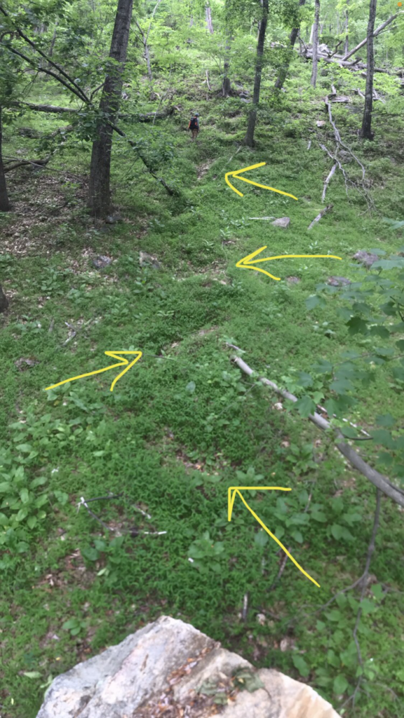
This was (and remains) the first and only boulder I have personally seen that has rolled or tumbled and come to rest recently enough for its track to be visible in the field. I thought the diagonal gouge marks were particularly interesting. For whatever reason, they caused me to visualize a slow, “waddling” rolling style like that of an American football or rugby ball rolling downhill. The boulder had not traveled particularly far across the flat area where it came to rest, and I thought the “waddling” style might explain this.
The boulder had, however, traveled down a significant slope prior to reaching the flat, and should have been moving at good speed. I could not really make sense of the gouge marks, travel distance, and steep slope origin. When I can’t visualize structural geology scenarios, I turn to sandbox models. I tried to do the same here, and I was easily able to produce alternating diagonal “zig-zag” rolling tracks with model boulders and a sand tray.
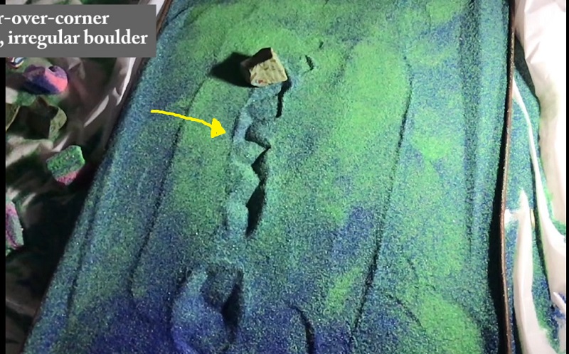
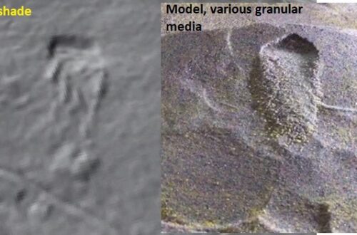
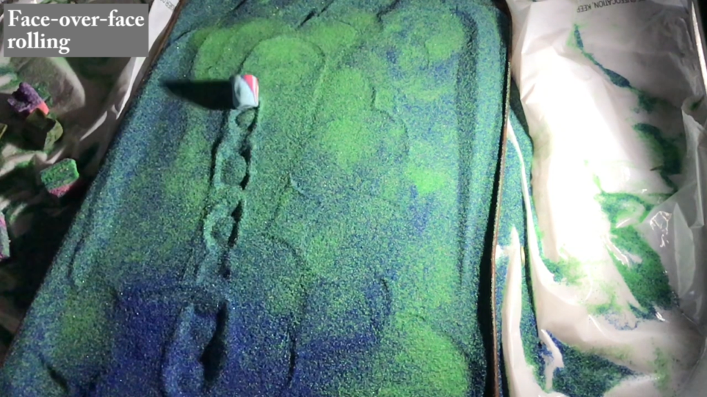
My model boulders were made of dried play-doh, which had been cut into shapes reminiscent of the recently emplaced Rutherford County boulder. I let these roll down a tilted strip of carpet, which caused them to tumble as they accelerated before rolling out across the nearly flat sand tray surface. Tumbling the model boulders turned out to be rather interesting, and was sort of like shooting dice for people that like geology and interesting visual patterns. To summarize the results of dozens of rolls, the model boulders produced either zig-zag tracks from corner-over-corner rolling or longer tracks with a helical pattern from face-over-face rolling. These rolling styles and the resulting tracks are shown in the video linked below (a helical, edge-over-edge pattern is shown in the link image).
Corner-over-corner rolling occurred when the model boulder did not tumble smoothly down the carpet and thus did not reach a high speed. Once a corner-over-corner roller hit the sand tray, it seemed to lose energy more quickly than the face-over-face rollers, presumably due to the deep gouging of the edges and greater length of the boulder’s diagonal. The image below shows the sequence in which the edges and corners impacted the sand to produce the zig-zag pattern.
Regular, face-over-face tumbling down the carpet allowed the boulders to reach higher speeds and travel notably farther across the sand tray. The helical pattern (below) results from a slight irregularity in the model boulder’s rectangular prism shape; one edge was slightly rounded.
The models made it clear that the real boulder probably did not make any sort of unusual “waddling” rolling style. Its shape, combined with corner-over-corner tumbling, would have allowed it to make the zig-zag, diagonal gouge marks in its track while rolling in a generally straight line at moderate speed. The corner-over-corner style is a less efficient and sort of off-axis style of movement, but I imagine that to an observer, the boulder would have appeared to simply be rolling at the time of its emplacement.
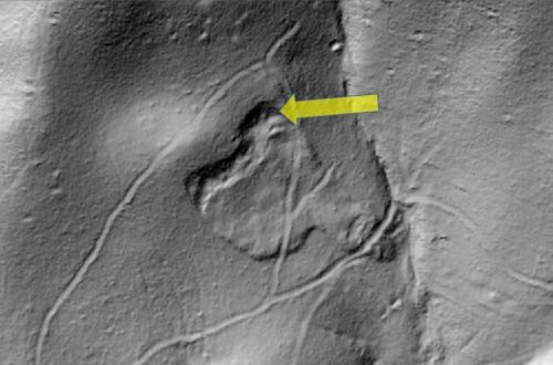
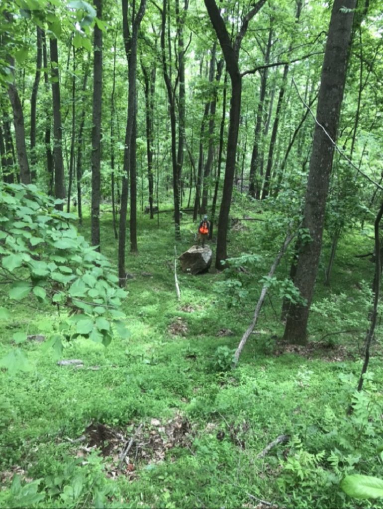
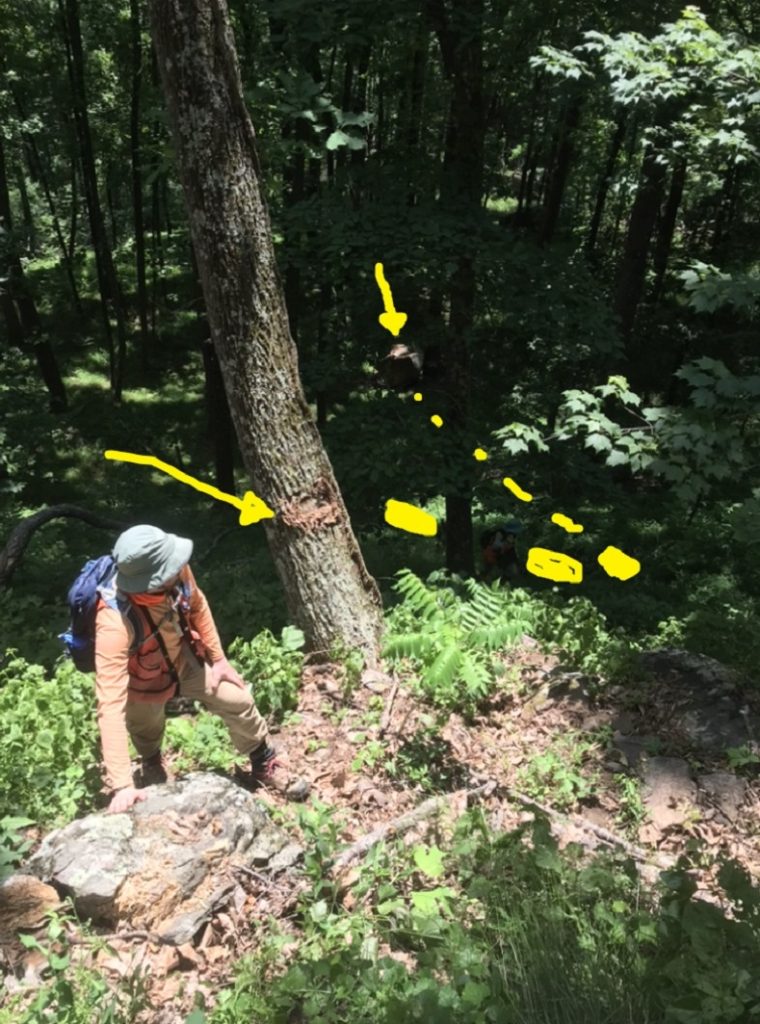
On a later visit to this site, we tried to find the boulder’s place of origin on the slope. The boulder’s track could not easily be traced by impact marks on the slope surface, but scarring on tree trunks made its path quite clear. Corey Scheip (BGC Engineering) examines one of the tree scars in the image below. The dash marks generally show the boulder’s path after the tree impact. It was deflected to the right before continuing downhill to its resting place, shown with an arrow in the darker portion of the image.
The boulder hit several trees on its way down, all of which bore similar scars. The trees were offset in their locations, suggesting the boulder deflected from one to another and followed a Plinko-style path down the slope. The lack of a straight path obviously limited the boulder’s speed and may have prevented it from attaining a faster, face-over-face tumble.
So, where does “trundle” figure into all of this? When I searched YouTube for videos of rolling boulders to try to better understand the origin of the diagonal gouge marks, I repeatedly found “boulder trundle” videos. Apparently, “trundling” is the act of purposely rolling boulders down slopes, often by prying them loose with levers. Limited field evidence still visible during our second visit to the site suggested that the recently emplaced boulder had started rolling after it was pried loose or struck by a falling tree. A tropical depression had passed through the area several months prior, and high winds along steep slopes had knocked down numerous very large oaks. The boulder’s tree scarring and faint slope track appeared to begin just below the base of one such felled oak, suggesting the rolling of the boulder was indeed a natural, storm-induced “trundle.” I’m not sure how often tree fall triggers rockfall in this region or elsewhere, but this scenario has certainly added another element to my own evaluation of possible slope hazards.