“Blowout” landslides and the lidar signature of extreme Appalachian rainfall events
by Philip S. Prince
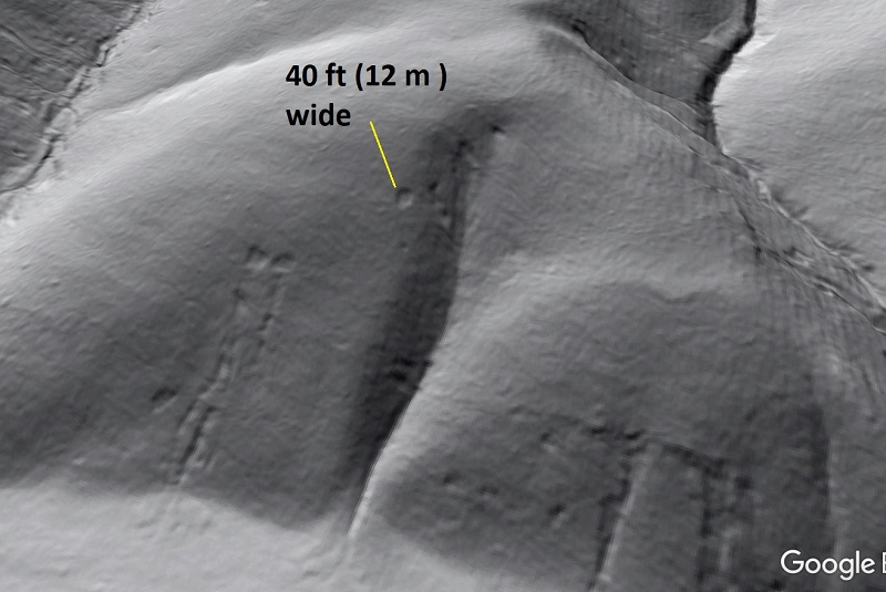
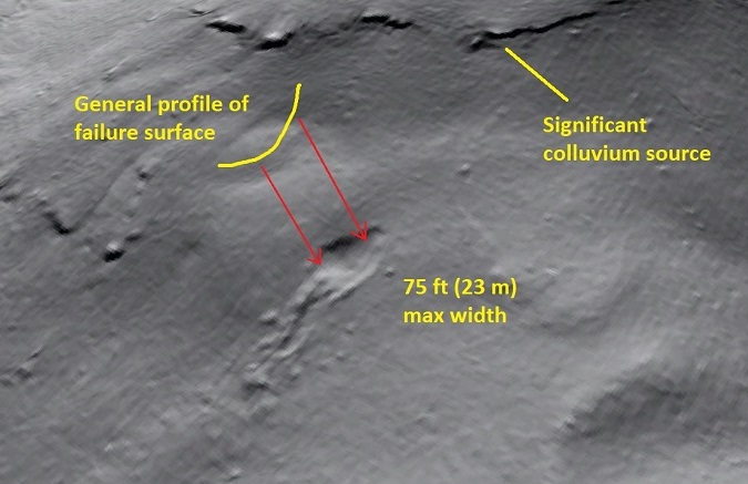
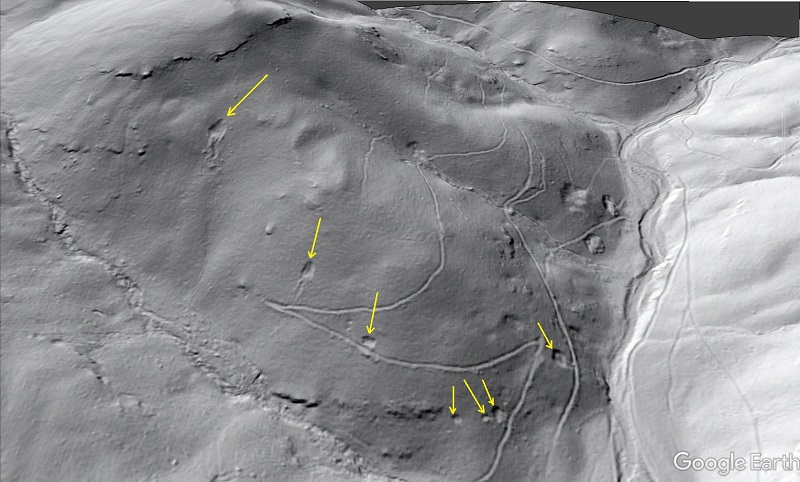
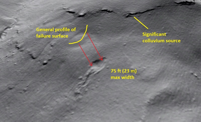
On the night of June 27, 1995, the Albemarle County, Virginia, mountainside shown below received an exceptional amount of rainfall. No one knows how much, but a nearby rain gage recorded ~ 11 inches (28 cm) of rainfall with only 2 hours…the rain event continued for several more hours. Unsurprisingly, a tremendous number of landslides resulted. The slides are clearly visible in this lidar hillshade image, and those marked with yellow arrows are of particular interest in the context of the storm’s outrageous precipitation rate and total, which likely reached 30 inches (76 cm).
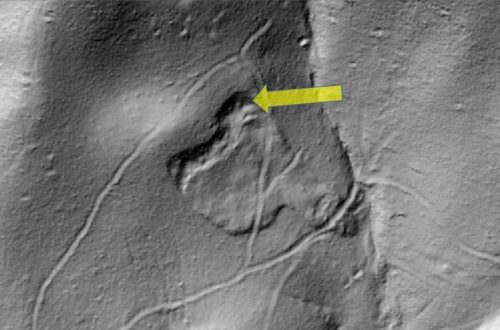
The slides highlighted by the yellow arrows are examples of what William Eisenlohr, Jr., called “blowouts” following a July 1942 storm that produced similar features near Port Allegany and Smethport, Pennyslvania, as a result of similar rainfall rates and totals. Below, a detail of the slide at upper left in the image above shows particular details of the type of failure that inspired the unusual “blowout” name: a curved failure surface and arcuate scar, no erosive track, no intact slide block, and debris spread as a sheet over the slope below. Notably, much debris is missing; the deposit visible below certainly doesn’t account for the volume removed from the scar.
These “blowouts” and their association with extreme Appalachian rainfall events (more than 10 inches (25.4 cm) in under 10 hours) offer up an interesting story about hillslope response to extreme rainfall and the very 21st century ability to see that response with 1 meter (or better) resolution lidar. Linked below is a full-length post I recently wrote about these slides on the Appalachian Landslide Consultants, PLLC, page, which shows blowouts related to atypical storms in several Appalachian settings:
Link to original Appalachian Landslide Consultants post
I usually don’t base a post on this site about external material, but in this case pasting a link is admittedly more appealing than re-posting all the figures and text. The Appalachian Landslide Consultants page also allows images to expanded to full screen with a click, which is a plus. Original reports about the slide events are linked in the full-length writeup, and I personally enjoyed checking out the sites highlighted in Eisenlohr (1952) and Hack and Goodlett (1960) (shown below) with 2017 lidar!