Low-displacement landslides explain unusual West Virginia landscape features visible in lidar imagery
by Philip S. Prince
Lidar-derived imagery reveals many fascinating details of Appalachian landscapes, some of which are initially a bit puzzling. Fortunately, if the imagery is sufficiently detailed, it can often provide a rational explanation for the puzzling features. Landslides in the early stages of movement (or slides that have experienced very little movement before becoming dormant) often generate unusual small-scale landforms like the examples in this post. While these features would be noticeable to a geologist on the ground, they are certainly best appreciated (and explained) with the help of 1-meter lidar data! These sites are all located in Randolph County, West Virginia, and would likely be nearly unnoticeable in lower-resolution digital topography data sets.
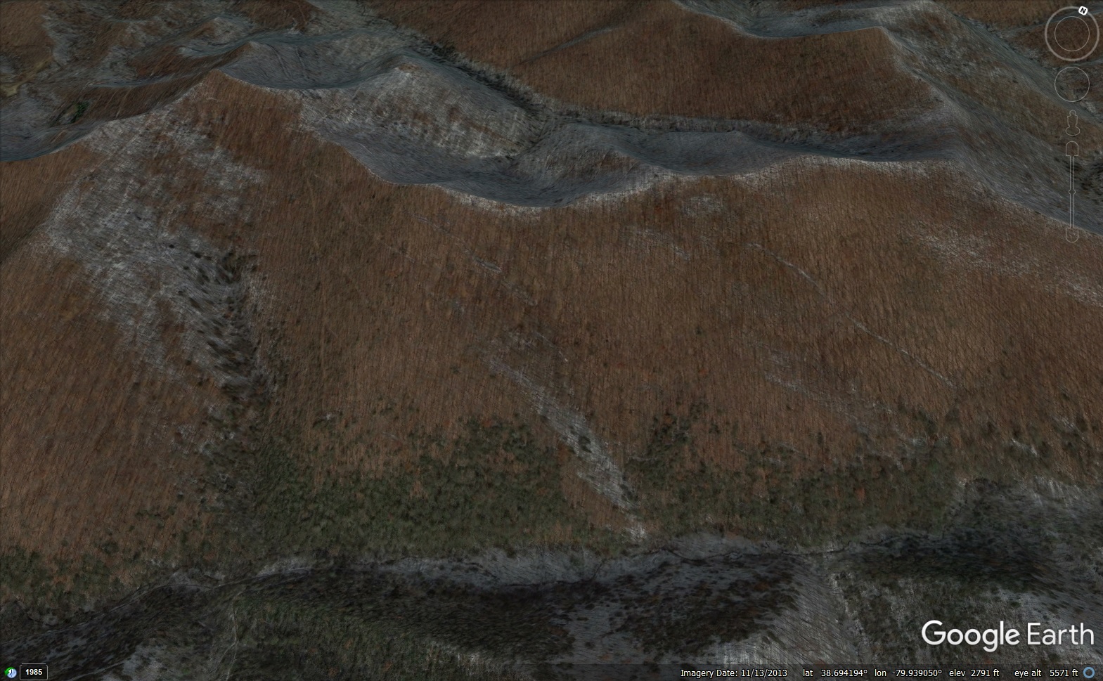
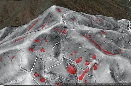
The mountainside shown below hosts several elongated trenches or gashes that are plainly visible in lidar hillshade imagery. A matching air photo image is shown for comparison. The trenches are nearly invisible in the air photo, and while they would be noticeable on the ground, their size (up to 200 ft or 60 m long) and the forest cover would likely obscure their context.
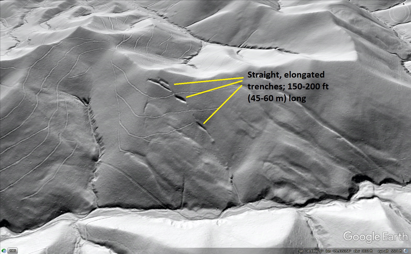
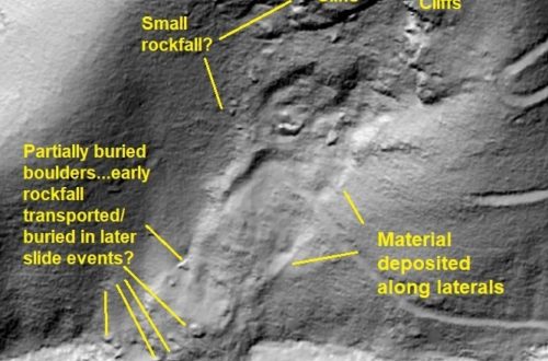
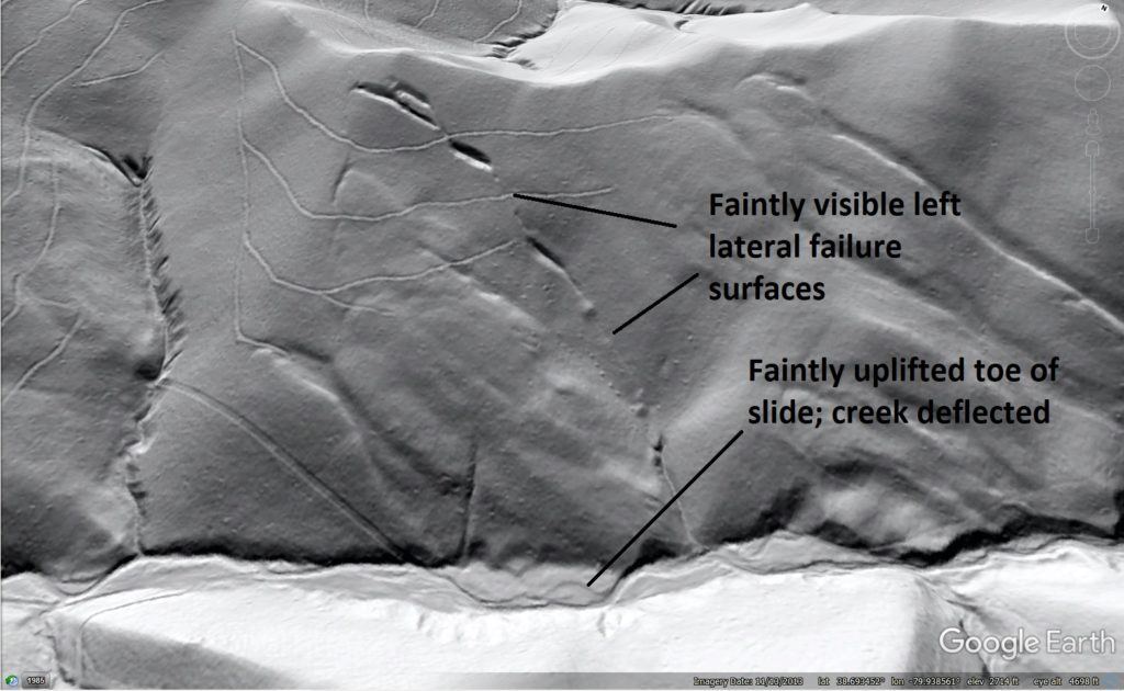
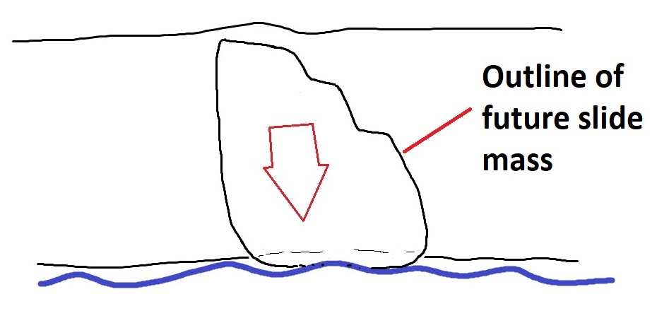
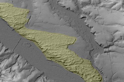
The trenches resemble mining prospects that are common throughout Appalachia, but this zone of Appalachian stratigraphy (Foreknobs Formation; upper Devonian) is not a mineral or coal producer. The trenches also do not cut perpendicular to bedrock strike, a common prospect orientation to expose numerous bedrock units in a single excavation. The trenches don’t follow the typical prospect rules because they are actually small “pull-aparts” along the edges of a large, thin blockslide (a type of landslide defined by a moving, intact mass of stratigraphy). The blockslide has only experienced a very small amount of downslope movement. The first image below shows the entire slide covered by a transparent polygon. The second image points out the laterals (edges) of the slide as well as its toe, whose slight movement has deflected the stream at the base of the slope. The laterals are very subtle and would likely be challenging to identify in the field on the heavily forested slope.
The “pull-aparts” are open gaps between the slide mass and intact slope. They are almost certainly filled with soil and organic debris to some extent, but do not appear to be full grabens, or downthrown blocks, of the slide mass. Presumably, grabens have not formed because the sliding mass is quite thin and the cohesion of the rock composing the sliding layer prevents the gaps’ edges from collapsing. The pull-aparts have formed at stepovers on the left lateral failure surface of the slide, and are thus a result of the shape of the slide mass and its direction of motion.
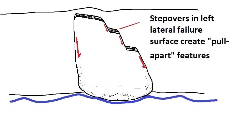
The stepovers and overall angular outline of the slide results from its development within highly jointed or fractured sandstone. As strength of the underlying shale layers is exceeded by the weight and downslope force of the sliding layer(s), the slide mass preferentially disconnects along existing weaknesses in the rock. I have not visited this slide and have no idea of its movement history, but logging roads cutting across it are not disrupted. Material stored in the pull-aparts or in uplifted stream sediments at the toe could provide some insight into when the slide was active.
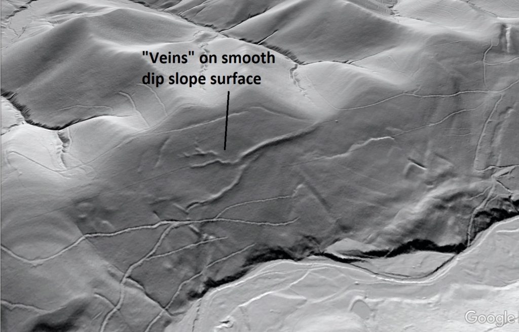
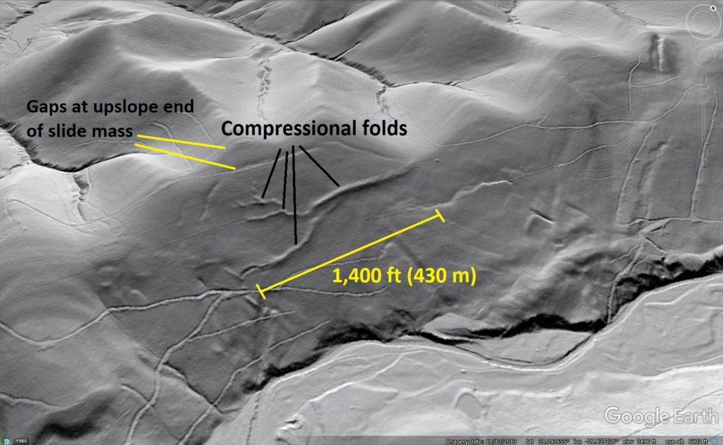
A few miles to the northeast on the same ridge face (and thus the same stratigraphic interval), an unusual vein-like pattern of tiny ridges is visible on the otherwise smooth slope. The “veins” extend 1,400 ft (430 m) along the face of the ridge, and are 40-60 ft (12-18 m) across.
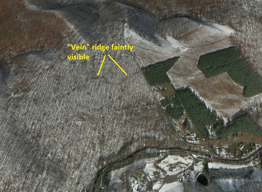
Like the pull-aparts in the previous example, the “vein” ridges would likely be noticeable in the field, but are only faintly visible in the zoomed-in air photo image below.
The “veins” are actually compressional folds developed within a very thin blockslide. Given the width of the veins, the sliding sheet of rock is probably 20-30 feet (6-9 m) thick or so, although this estimate depends of the geometry of the folds. Lidar is again beneficial in interpretation, as it reveals subtle gaps at the upslope end of the slide mass that result from slide movement.

Compressional folding of this type is actually observed in other blockslides in the Appalachian Valley and Ridge, where sliding sandstone layers are so intensely fractured that they can fold at the surface without shattering (see this link). In this Randolph County example, the extremely narrow width of the folds and implied thinness of the slide mass is particularly interesting. The conceptual relationship between fold crest width and the thickness of the slide mass is illustrated below.
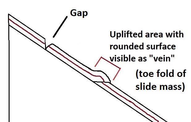
The very basic illustration above shows a simple hanging wall anticline above a thrust ramp at the toe of a blockslide. Many other possible fold and fault related geometries are possible, but almost all involve a fold width notably greater than the thickness of the sliding mass. Given that the slide is 1,400 ft (430 m) across and likely under 40 feet thick, it really is moving like a thin sheet of snow sliding on a windshield as portrayed in the link above. The diagram below is not scaled, but it offers a conceptual view of the slide geometry.
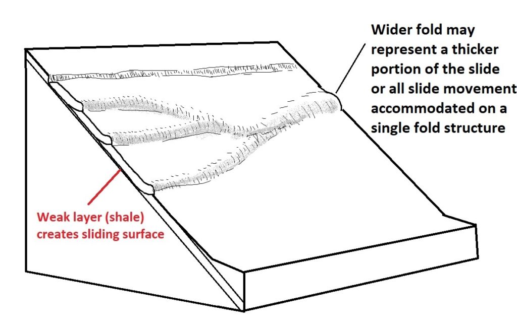
The diagram is broadly based on the three folds visible on the slide, along with the faint upslope gap.
Low-displacement blockslides like these dominate the southeast face of this ridge for about 15 miles (25 km) in Randolph County. While most are limited to the face of the dip slope, some failures are positioned in a way to affect the actual ridge crest, like the slide shown below. In the field, the effects of this slide would be apparent as an elongated depression along the ridge.
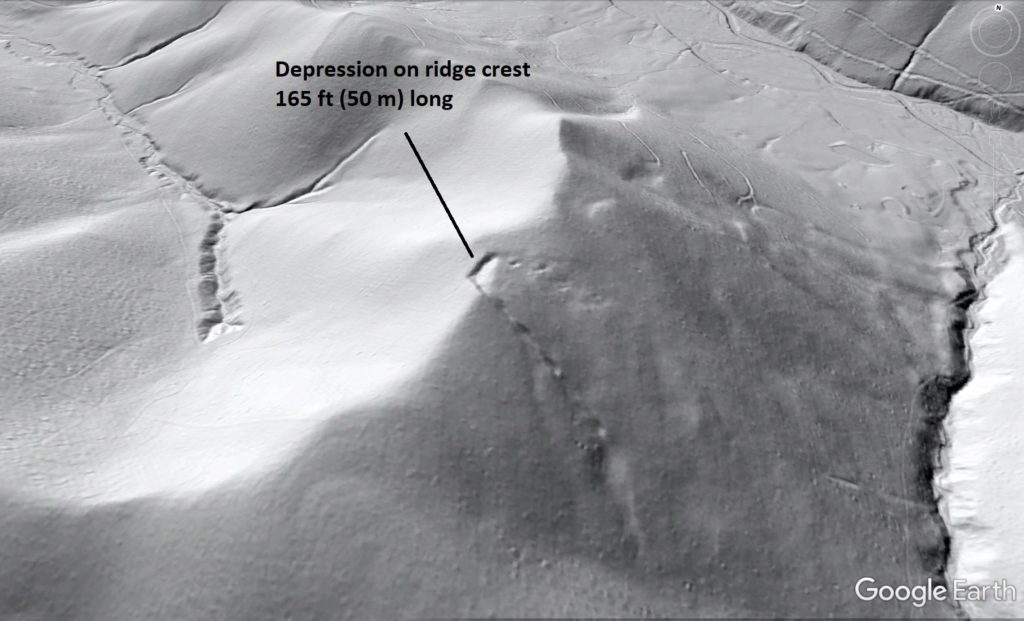
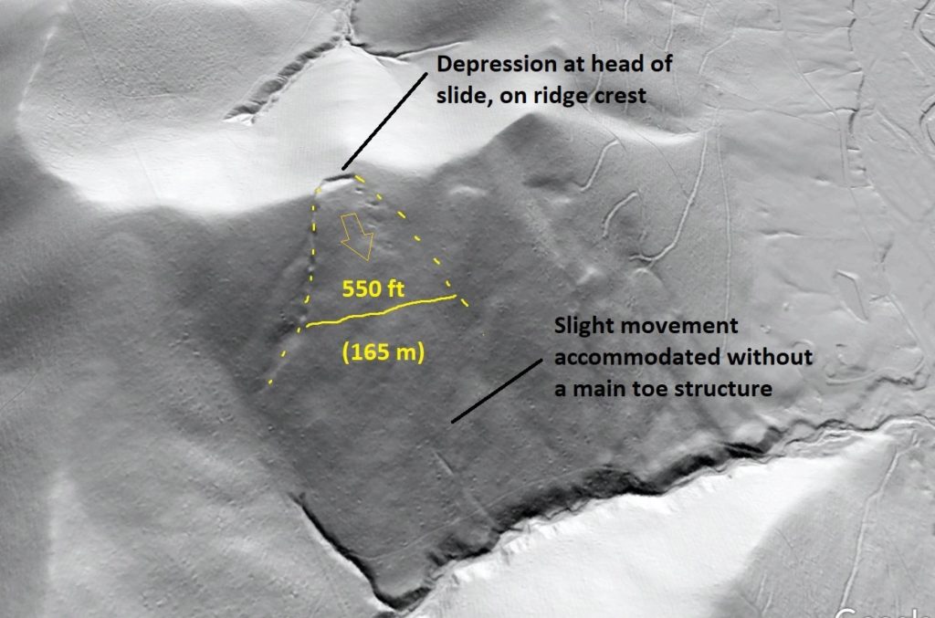
This slide has also experienced only a tiny amount of displacement, allowing the movement to be accommodated downslope without a defined toe.
Like so many older landslides in the Appalachians, the significance and cause of these features is unknown. Because they are so numerous and are only visible using lidar data acquired in 2016, they may represent an untapped resource of useful information about the recent history of Appalachian landscapes.


You May Also Like
Lidar highlights impressive landslide density on the southern Appalachian Blue Ridge Escarpment, western North Carolina
Pleistocene Coastal Plain sand dunes and the value of pattern recognition in LiDAR interpretation