Another track left by huge boulders visible with lidar, Big South Fork National River, Kentucky
by Philip S. Prince
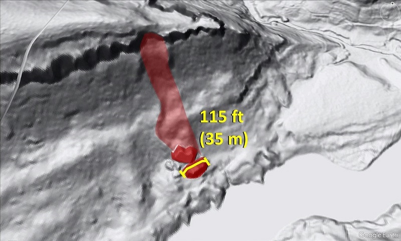
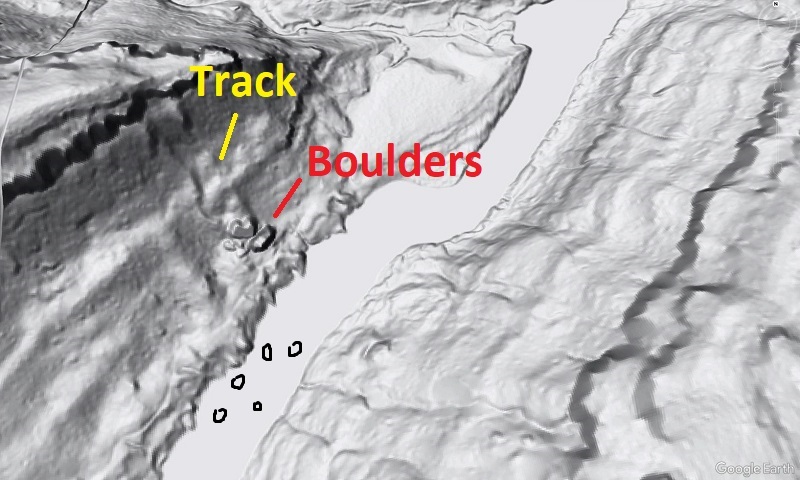
As rugged and/or high topography in Appalachia tends to result from outcrop of particularly hard and weathering-resistant rock, steep slopes in the Appalachians are often home to boulders, some of which are quite large. An interesting aspect of the boulders is that very few have been known to slide or roll into place since folks started recording such things, and they very, very rarely show visible tracks or paths downslope in lidar-derived imagery. The question of how the boulders got to their resting place is legitimate (more on this below), but sometimes, lidar serves up a nice answer, as in the case of the two huge (115 ft or 35 m long) McCreary County, Kentucky, boulders shown below. The boulders and their track are highlighted in the lower image for comparison to the bare lidar.
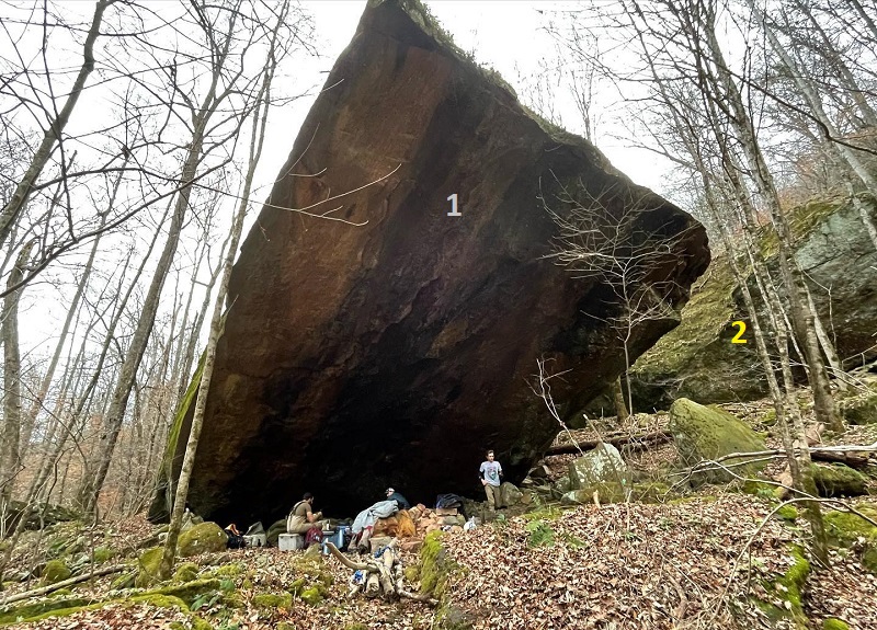
I got tipped off to this feature when a friend posted a shot of the lower boulder (the one with the measurement bar, above) on Facebook, shown below. It’s an impressive image, and gives a sense of the boulder’s scale relative to human observers. The second image below uses a large arrow to show the general perspective of the photo, which also gives a glimpse of the second boulder (2) in the background.
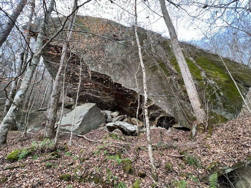
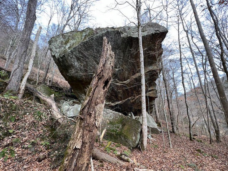
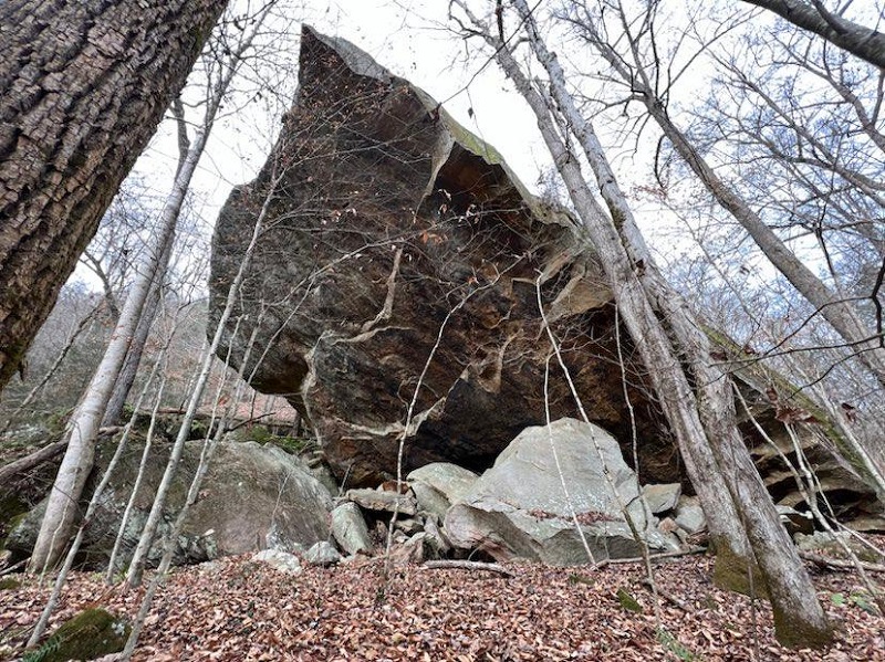
The path carved by the boulders is as wide at the boulders’ long dimension, which suggests (I think) that they slid into place instead of tumbling, without turning much on the way down. The plowed-up path appears to be about 10 ft (3 m) deep, but is entirely re-vegetated with no obvious distinction in vegetation. The additional photos of the boulders below show that they are now just “part of the forest,” so to speak.
The boulders are Pennsylvanian-aged quartz-rich sandstone (possibly Rockcastle Formation?), so they are physically and chemically very tough and look to be well-preserved. I have not personally been to these boulders, but it’s likely that a geologist could easily establish which sides of the boulders were facing up and out (the old cliff face) prior to detachment and emplacement. Reddish-brown oxidation on the underside of the boulder in the image above might be a clue to this sort of interpretation, but I’m not sure.
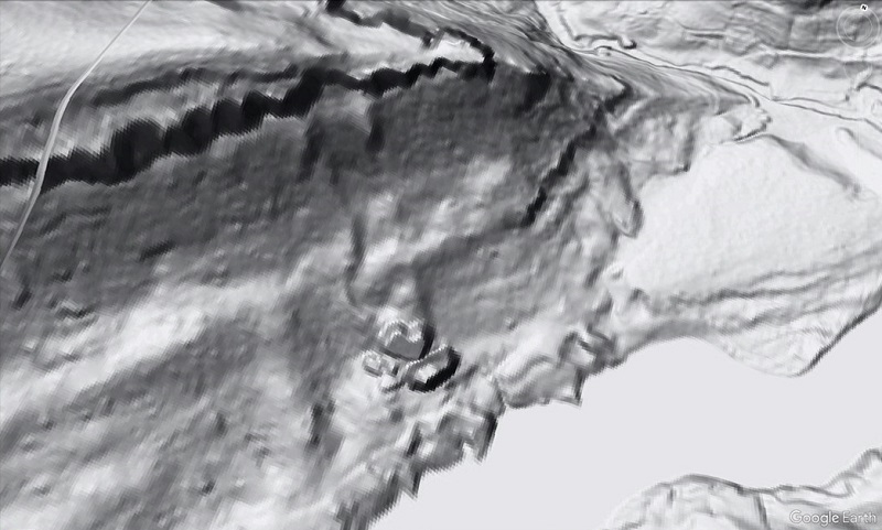
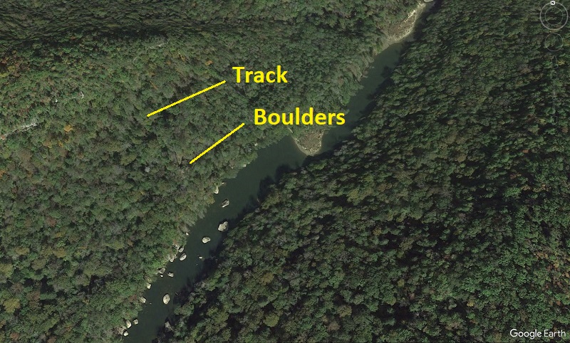
The boulders are located along the Big South Fork National River, which carves a steep gorge through the Pennsylvanian-aged geologic section in northern Tennessee and southern Kentucky. The river itself is full of boulders in this area, but most are processed out of the lidar data. The Google Earth image below shows the river in the vicinity of the giant boulders, and is paired with a matching lidar overlay for reference to the tracked boulders.
This “tracked boulder” example is particularly interesting because it provides direct evidence that the boulders traveled overland to their resting place, likely in one big event. Falling, sliding, or tumbling during a major failure are not the only ways boulders might move downhill. Rapid weathering of weak or soluble rocks below the cliff line might allow pieces of the cliff line to be gradually lowered as the underlying bedrock weathers away, causing a former cliff line position to decay into a line of scattered boulders. Boulders might also slowly creep downslope if the underlying soil or rock are sufficiently unstable, particularly during wet climatic patterns or aggressive freeze-thaw cycles. I think (but am not entirely sure) that both of these non-falling processes are either documented or suspected in cases of apparent large boulder movement elsewhere in the world. In this Big South Fork case, however, the physical evidence suggests the boulders failed and slid in an impressive event and plowed a 3 m (10 ft)-deep path down the slope. Knowing that boulders can and do move like this in the Cumberland Plateau landscape is useful to understanding potential hazards and how best to interact with the landscape, particularly from an engineering standpoint.
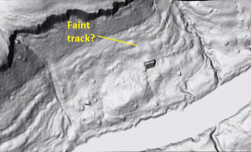
Understanding why more boulder tracks aren’t visible in a region as bouldery as the rugged parts of Appalachia (throughout its provinces–not just sandstone-capped Plateau areas) is another interesting question. Plenty of large boulders are found near the tracked example discussed here, but none show any obvious surficial evidence of their path downhill. One 28 m (~90 ft) long boulder immediately downstream might be argued to show a well-weathered track, but detailed analysis of soil in the possible track relative to surroundings might be necessary to confirm it. I don’t think the lidar-derived imagery alone is convincing enough.
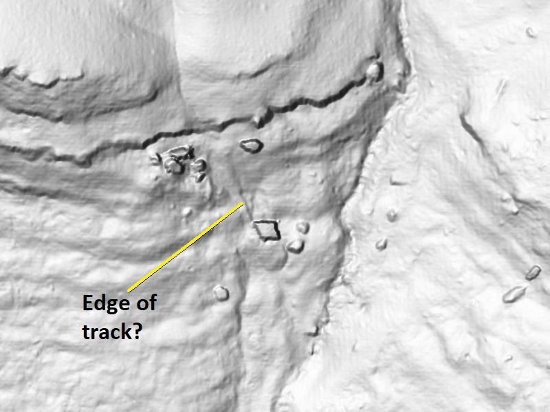
The only other good candidate I have seen in the Cumberland Plateau occurs about 200 km (125 miles) southwest, across the Sequatchie Anticline from Chattanooga, Tennessee. This 20 m (65 ft) boulder, also of Pennsylvanian sandstone, appears to have left a short track, though its point of origin is unclear. A scar shaped like the boulder’s upslope edge may be visible just uphill, suggesting a small amount of travel that occurred after the boulder was separated from the outcrops upslope.
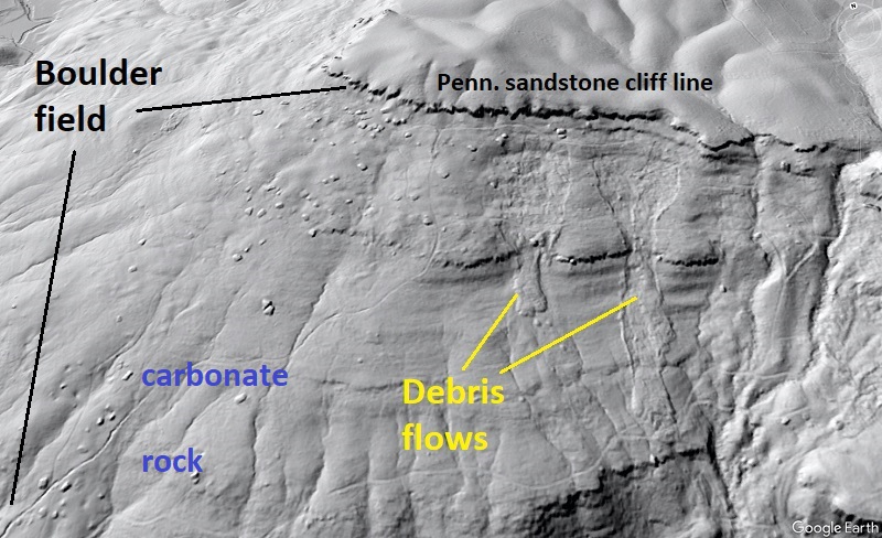
Many Cumberland Plateau slopes are absolutely covered in boulders, but are comparatively gentle (less than 20 degrees) and seem less likely to support rapid and significant boulder travel by slide or rockfall events. The slope shown below is a good example. It is covered with 15 m (50 ft) boulders that suggest association with the cliff line, but just how they ended up so far from the cliff line on a <20 degree slope is another question. Here, dissolution of carbonate rock may indeed play a role, suggesting evolution of the landscape visible in the image represents a very complex interplay of processes. The cool debris flows are an added visual bonus–did they mobilize any boulders?
This post is Cumberland Plateau-focused because the rock types and structure that produce its landscape make visually impressive boulder examples, but the questions raised here apply to the Appalachian Plateau to the north, the Valley and Ridge, and the Blue Ridge and westernmost Piedmont. All of these provinces host many impressively boulder-covered slopes, and seldom do the boulders offer any evidence of when or how they ended up where they are today. Understanding boulder separation from outcrops and downhill movement goes beyond just being interesting–it can improve understanding of how climate history shaped the landscape as well as how dynamic hillslopes can be. As lidar-derived imagery offers a new way to look at boulders on forested slopes, geologists are likely to greatly expand understanding of Appalachian hillslope evolution in coming years.