Erosion and scour in sandbox model debris flows (microbeads and cohesive substrate)
by Philip S. Prince
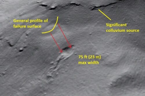
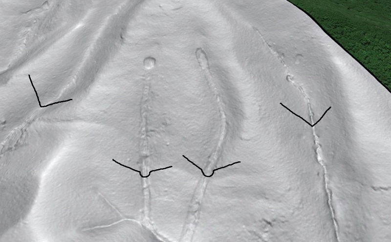
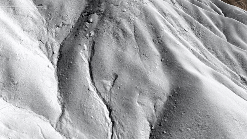
The speed and mobility of debris flows make them particularly dangerous among landslides. Debris flows move so quickly because they are fluidized masses of saturated soil, boulders and rock fragments, wood, and water, which causes them to erode or scour their flow path and accumulate more material than initially failed on the slope. The eroded track left by the scouring process is often clearly visible in lidar imagery, as in the case of the two debris flows shown below. These flows occurred in July 1995 near Buena Vista, Virginia, in the Appalachian blue Ridge. The respectively round and elliptical failed areas, along with the scoured tracks, stand out in comparison to “normal” ravines and channels on the slope.
The failure scars (at the head of the scoured tracks) are about 65 ft (20 m) wide. The flows were about 25 years old when this Google Earth imagery was taken, and forest recovery in the scoured tracks is still limited to hardy species like pines. Looking more closely at the scoured tracks, they show a U-shaped profile compared to the typical V-shaped profile of channels or ravines sculpted by water alone.
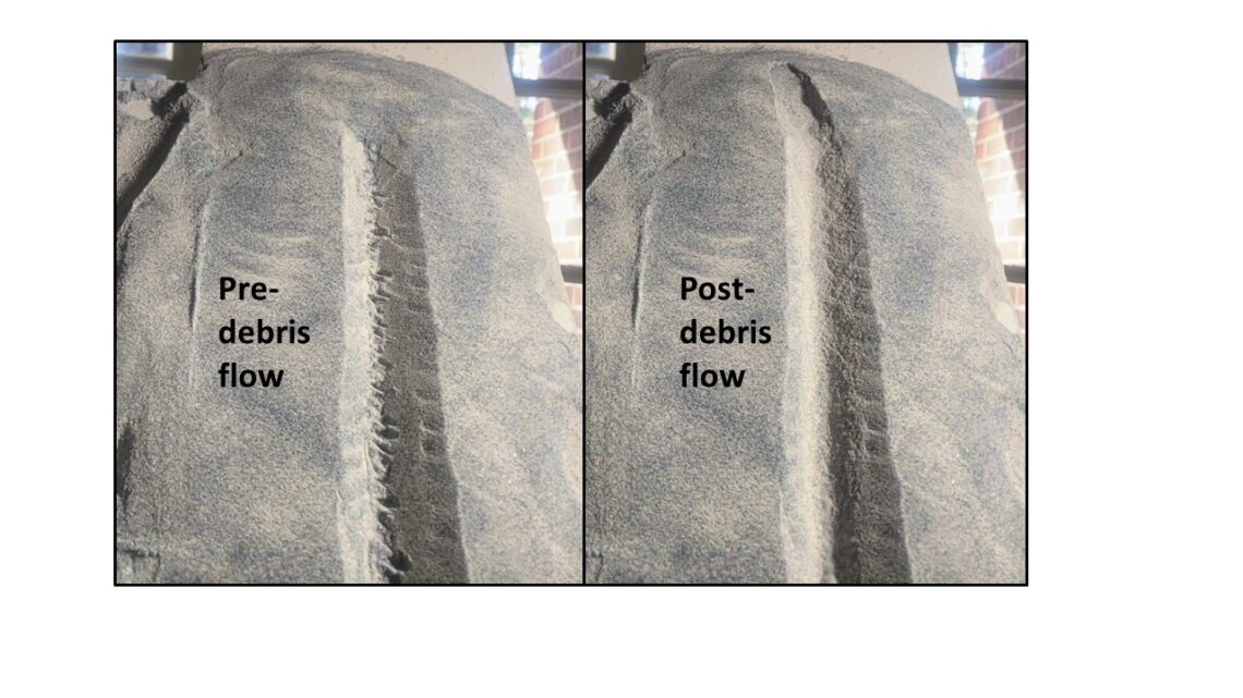
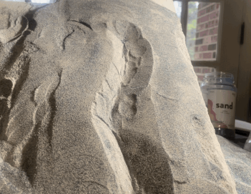
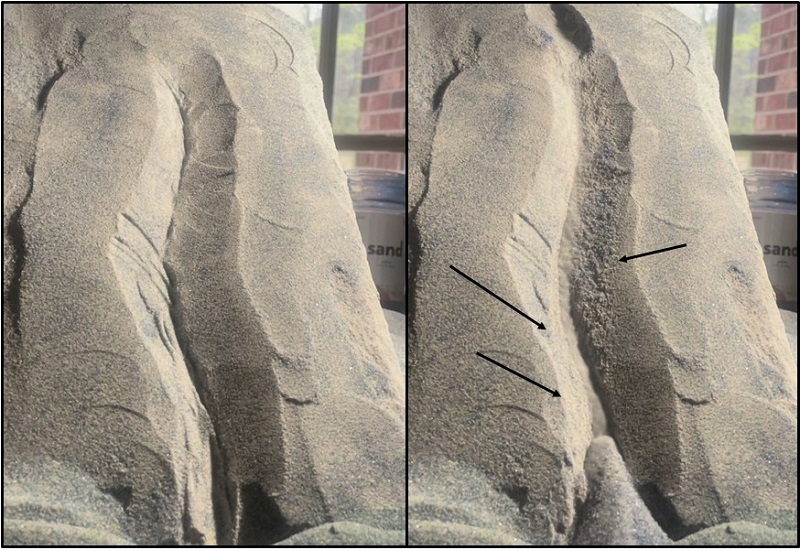
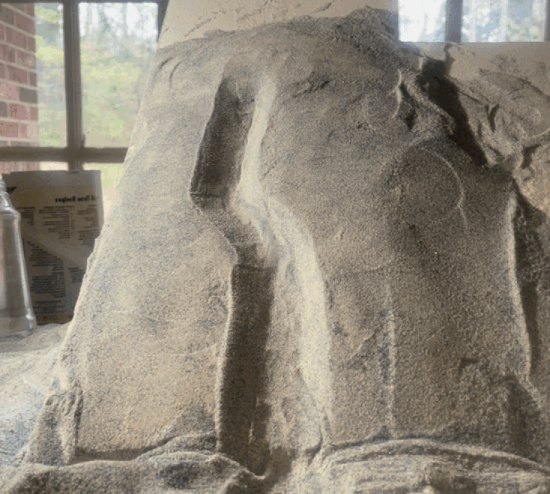
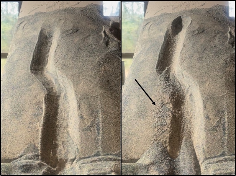
I look at these scoured tracks in lidar imagery all the time, and I wondered if might be possible to use granular analog materials to create similar eroded tracks in a sand model. Using a sand-flour mixture to make a cohesive slope was a V-shaped channel sculpted into it, I triggered slides of glass microbeads at the channel heads. The microbeads tend to fluidize when they are moving and colliding with one another, producing a dry analog for a natural saturated flow with lots of rocky debris. As seen below, the model flow does indeed erode the underlying slope and entrain the eroded material, added to the flow volume. I roughened the bottom of the initial channel to make the results of the scouring more noticeable.
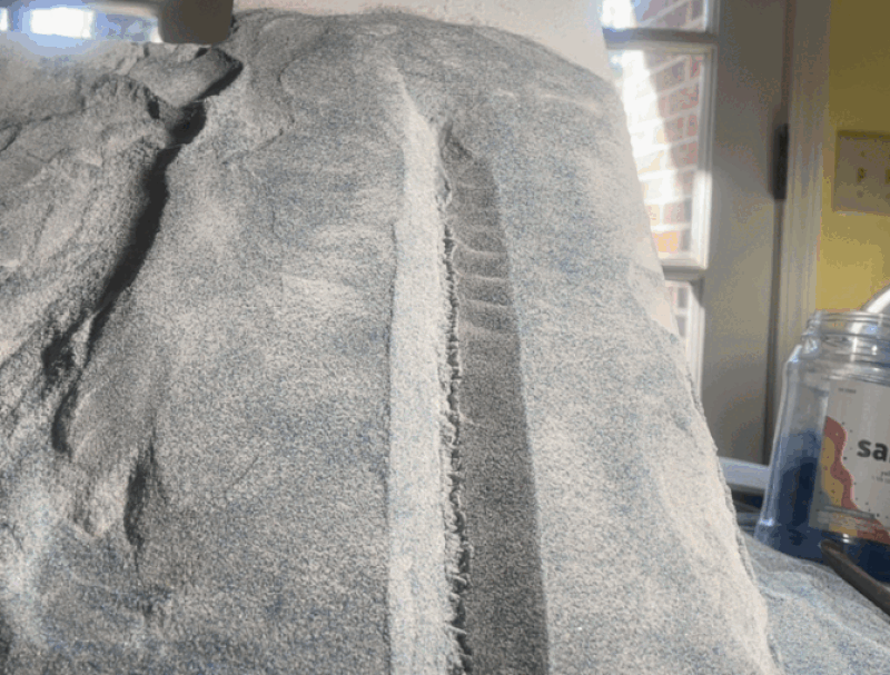
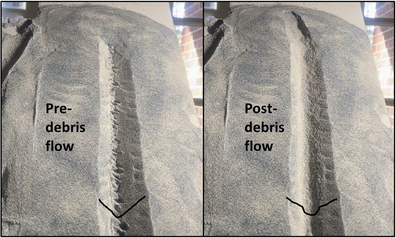
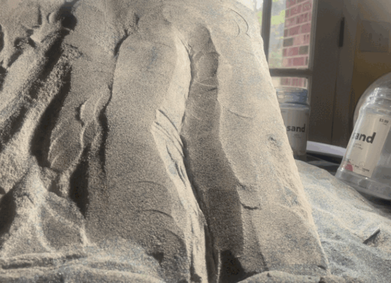
This is a simple model, but the effects of the flow on the initial slope condition are easy to see. Greater flow/track length would be good, but keeping the cohesive slope material stable on top of the tilting model base is difficult, and only gets more difficult as the model is scaled up. The flow is the most erosive towards the lower part of the model channel, where it is most concentrated. The image below provides a nice start-to-finish comparison.
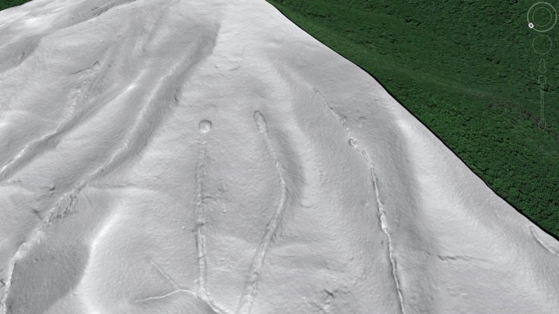
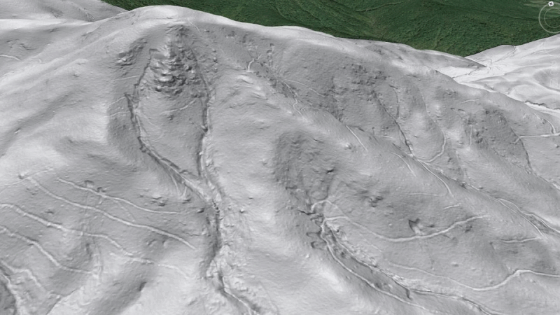
Debris flows also surge up slope due to their momentum as they move around channel bends. Evidence of this process is visible in lidar imagery, as in the case of the 1995 debris flow shown below, which occurred near Graves Mill, Virginia. Like the previous example, vegetation is yet to fully recover. The transparent red outline shows the limit of scouring by the flow; the thin blue line shows the present-day water channel. Arrows show where momentum of the flow caused to it to run up, or superelevate, on the slopes.
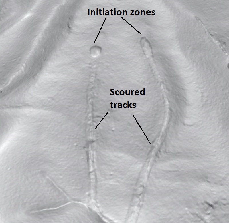
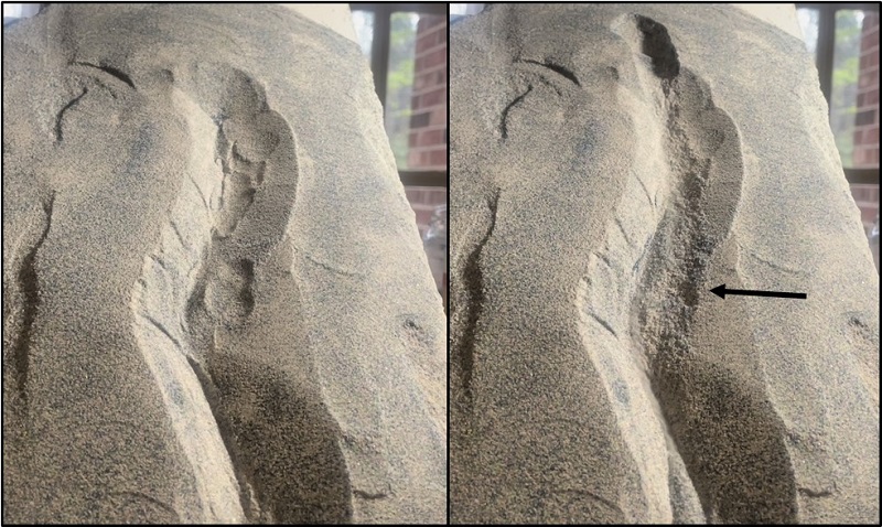
The same model flow setup will produce some amount of the superelevation effect, along with scouring, if a curving initial channel is constructed. The GIF below shows one experiment.
The model flow superelevated twice, with the most obvious scour indicated by the black arrow. Removal of the surface lumps and bumps from the starting channel (left) is apparent in the post-flow appearance (right).
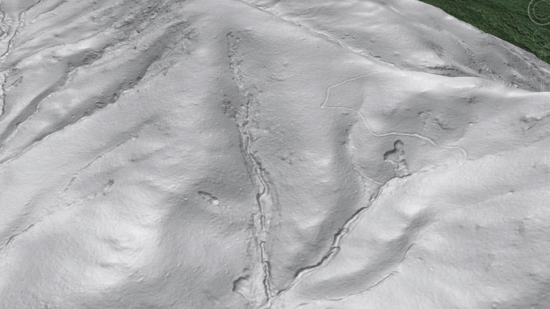
Another Graves Mill lidar example is shown below, with arrows indicating subtle evidence of scour due to superelevation of the flow. More on this event and its lidar signature can be found at this link.
Another curving channel example is seen below. This one also superelevated twice, with the second superelevation leading right into the zone of deposition. These flows don’t go very far once they leave the steep portion of the slope/channel because they are dry…see the video link at the end.
Comparing pre- and post-flow imagery shows erosion by the flow clearly, with initial texture in the channel scoured away where the flow was most concentrated.
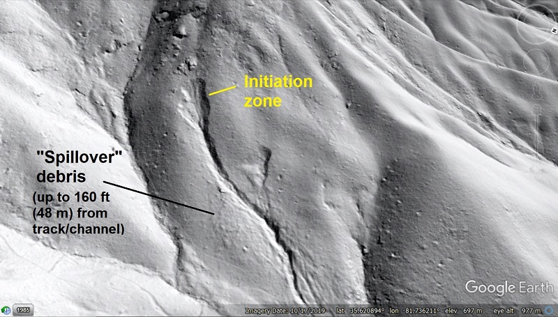
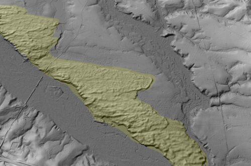
A final example of flow behavior from McDowell County, North Carolina, shows how flow material can completely overwhelm a shallow channel due to volume or velocity and spread out over a flat slope. The transparent red area shows surfaces affected by the flow; whether the textured area to the right of the channel is eroded or holds deposited material (or both) is not entirely clear.
The following GIF shows this type of movement, with “spillover” debris leaving surface texture outside of the pre-formed channel.
Situations like this are actually quite common in the southern Appalachians, particularly with flows that occurred during the most extreme precipitation events (more than 10 in/25 cm of rain in less than 10 hours). Storms that generate this much rainfall have produced several “splashy” flows in which rock and boulder debris has surged out of channels and cascaded across generally planar slopes, often for significant distance. The lidar signature of this type of movement can be subtle, but it is identifiable once you’ve seen it. My main purpose in making models like these is to support pattern recognition in remote sensing, and this model came out very nicely.
These out-of-channel surges are not dramatic in lidar, but they do promote thought about debris flow mobility and just what parts of steep slopes are actually safe during extreme rain events.
The following video link shows footage of all of the models, along with the deposits left by the models. Because they contain no fluid, the flows grind to a halt fairly quickly when slope and velocity decline. Most deposits end up preserving a “jet” of microbeads within a broader area of less mobile material, including what the flows scour from the channels. In real, saturated flows, the jets of microbeads would be actual fluid material, which would blast through the deposit to leave a channel flanked by levees of coarse debris.


You May Also Like
Pleistocene Coastal Plain sand dunes and the value of pattern recognition in LiDAR interpretation