LiDAR reveals the cloth-like appearance of a “wrinkled” translational landslide
Philip S. Prince
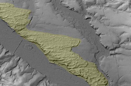
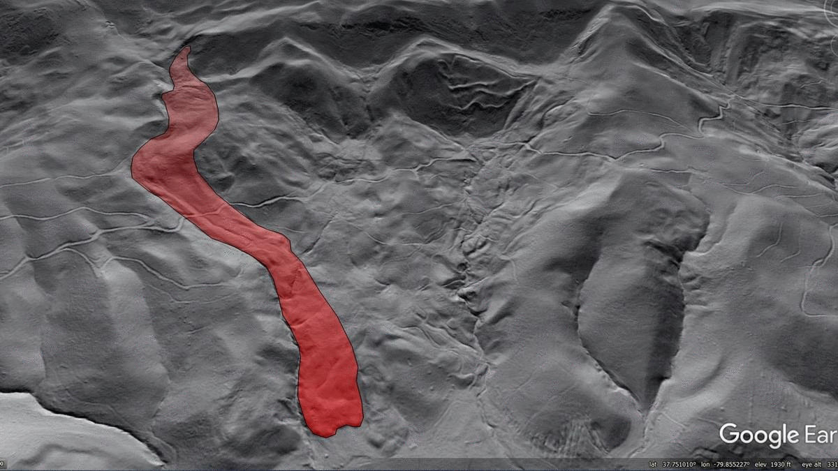
The Virginia Valley and Ridge hosts plenty of amazing landslide features, but this wrinkled translational slide in Botetourt County, Virginia is particuarly eye-catching. It reminds me of the wrinkling that might occur in a thin layer of cloth pushed along a smooth surface–something like pushing a napkin or tablecloth along a tabletop. The slide is located at 37.746443N 79.859919W at about 2,000 ft (610 m) above sea level.
This feature is probably best described as an intact rockslide or blockslide, as it involves a very thin Silurian-aged sandstone layer that has moved downslope. The “wrinkles” are anticlinal folds associated with small thrust faults in the slide mass. The sliding sandstone layer is definitely quite thin compared to the overall dimensions of the slide, creating the narrow folds. Movement on closely-spaced joints in the sandstone layer allows it to fold on the surface without completely shattering, permitting the cloth-like appearance to develop within a layer of rock.
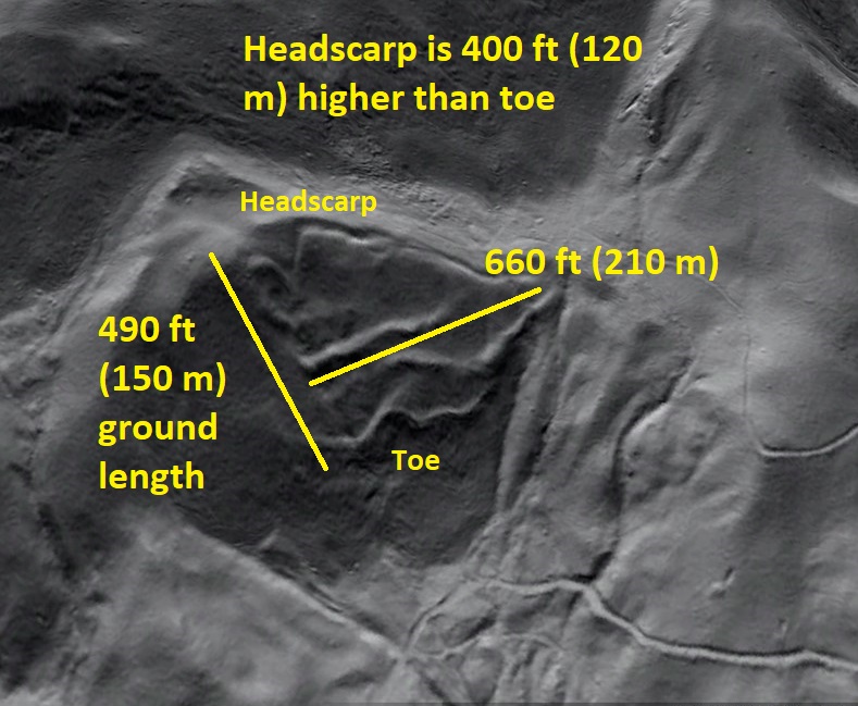
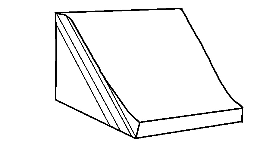
The conceptual diagram below gives a general idea of the type of movement and deformation that creates the wrinkles. They form as the slide “telescopes” onto itself. Dimensions are exaggerated in the drawings, and a notable feature of the real slide is that very little downslope movement appears to have occurred–in other words, there is only a small gap between the headscarp and the slide mass. For this very small amount of movement to create a number of obvious folds, the sliding sandstone layer must be very thin.
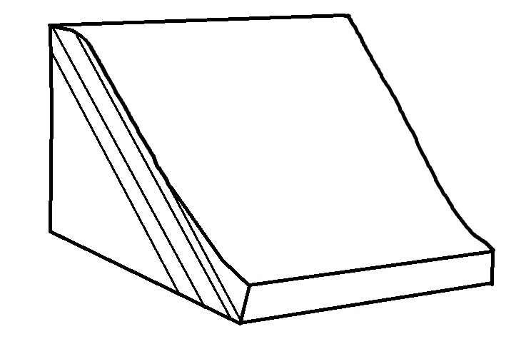
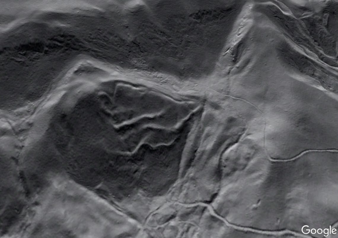
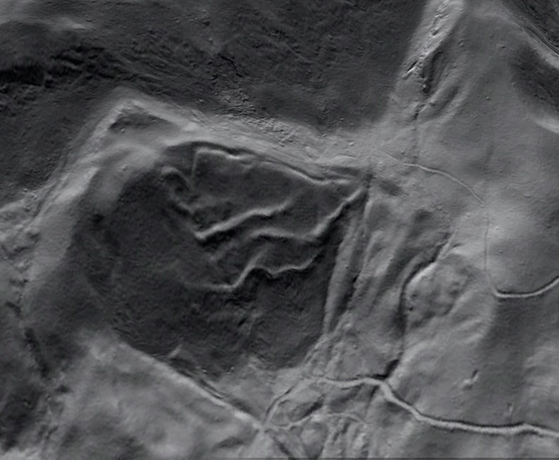
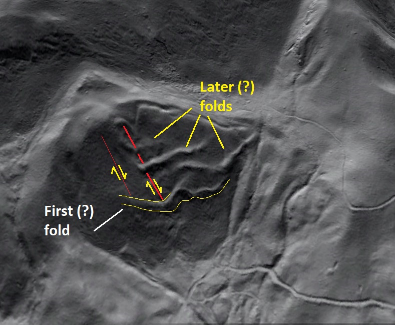
The diagram proposes that the lowermost fold develops first. I cannot confirm that this was the actual sequence of events, and I think a geologist could argue for it being first or last. Details of the lowermost fold (which I call the “first fold” in upcoming images) suggest an interesting style of movement within the lower parts of the slide. It appears that the slide mass may have wedged under the first fold in backthrust-type motion, locally arching it and creating a bulge that passes underneath the first fold.
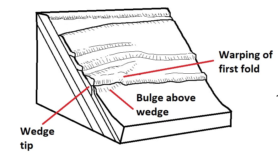
This pattern of movement would explain the very steep upslope side of parts of the lowermost fold, along with the bulge that passes beneath the fold at an angle. In motion, the sequence might look something like this:
I have observed several other thin translational slides in the region that appear to show wedging or backthrusting at their downslope end. Thinness appears to be necessary for the geometry to develop; thicker slides never show it, and a forethrust would likely develop in a thicker slide before noticeable wedge/backthrust motion could occur. As with all of the other Valley and Ridge slides I have written about, age, duration, and sequence of the slide’s movements are completely unknown.
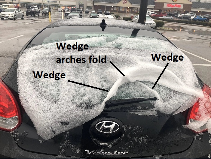
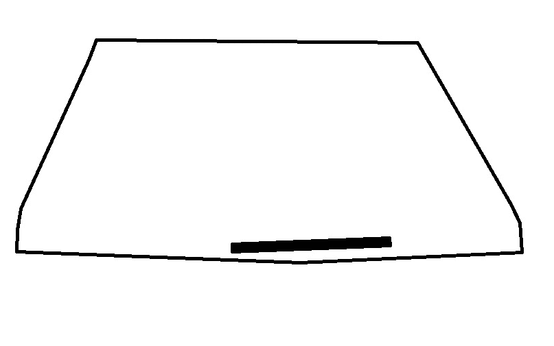
To reach beyond the cloth analogy, a similar type of movement can be observed when a thin layer of snow slides down a car windshield and piles up against the windshield wipers or hood. I actually Googled “snow sliding down car windshield” and was rewarded with a decent match, found at this link. Interestingly, wedge/backthrust features are present, and they appear to arch earlier folds. Movement here is somewhat different, however, due to the “scissor” motion of the snow sheet, which created two overlapping frontal folds (see the GIF below). The original poster of this image also used the cloth comparison for the snow sheet.

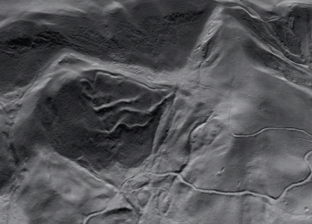
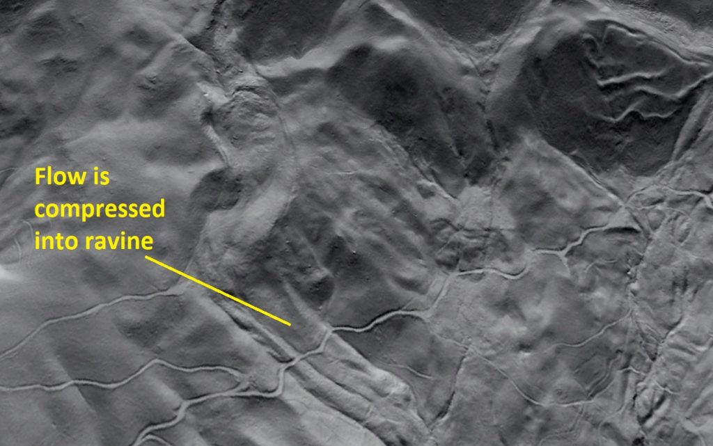
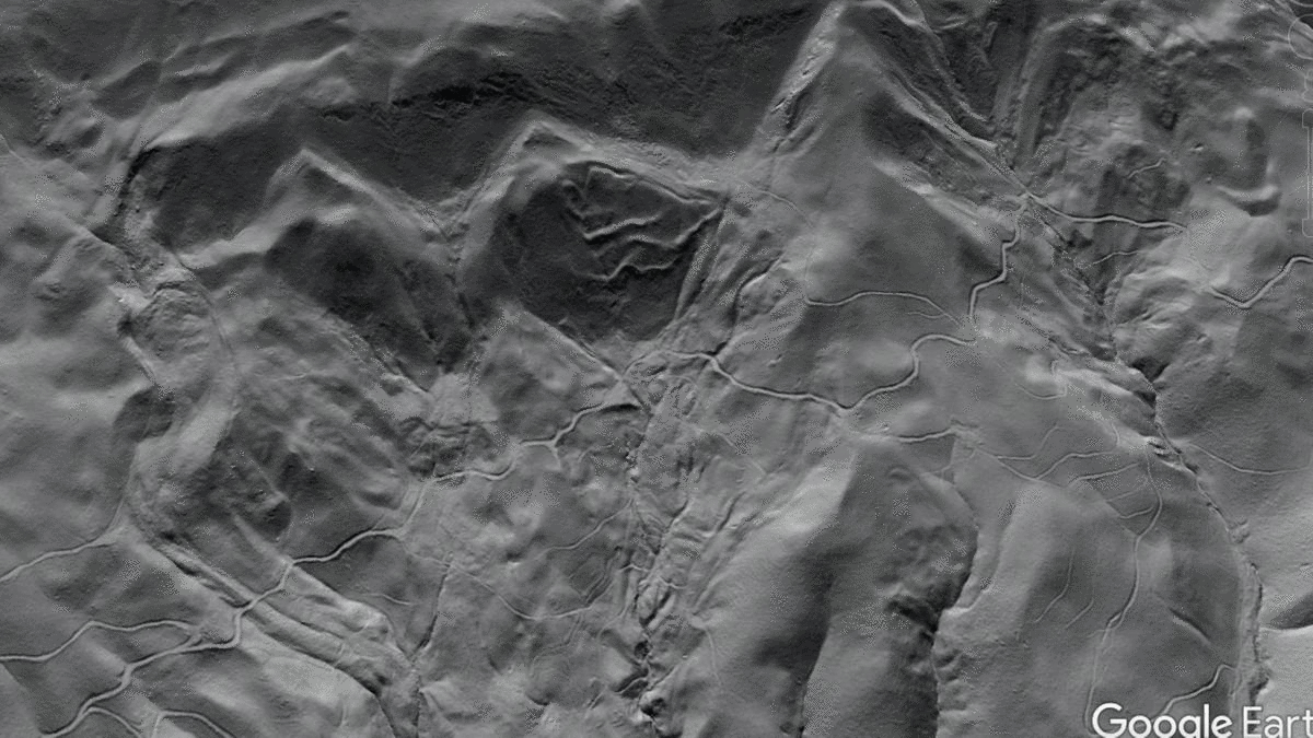
The wrinkled rock slide shares the mountainside with an equally impressive rock avalanche feature just 2,000 ft (650 m) away to the southwest. The rock avalanche moved downhill in a very different way, but it resulted from failure of generally the same part of the layer sequence, although it likely involved more sandstone layers than the thin one that produced the wrinkled slide. The wrinkled slide is visible above and just right of the center of the image.
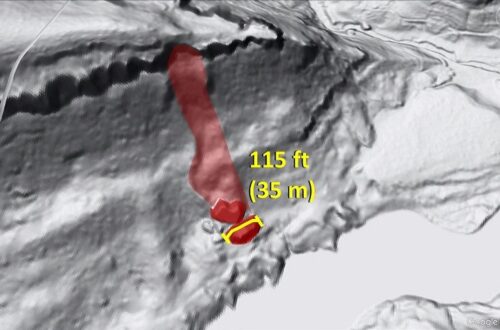
The rock avalanche feature looks like cake batter moving down the slope. It traveled 4,100 feet (1.3 km) overland from its source to the floodplain at the base of the slope, descending about 1,200 feet (365 m). Interesting flow features are visible within the deposit, particularly along the edges of the feature and where it was compressed into a narrow ravine. They are probably described by specific terminology that I admit is unfamiliar to me. Some spillover of material from the flow may also have occurred, but this may also represent earlier flow events.
The entire area between and downslope of the wrinkled slide and the rock avalanche is mantled with older landslide deposits. An older and more degraded rock avalanche feature also appears to pass by the right edge (northeast edge) of the wrinkled slide.
All of these features are testament to the very dynamic slope history of this part of the Virginia Valley and Ridge. Instability is inherent to these slopes, and is probably a combined result of the types of layered rock present on the slopes, the orientation of the layers relative to the slope, and the increase in topographic relief in the area due to incision by streams of the James River Basin. Paleoclimate may have contributed significantly to slide development, and seismic events can not be ruled out as a contributing factor. The collapsing Glen Wilton and Callie iron mines are located 2 miles (3.3 km) northeast along the same ridge, and these features demonstrate possible effects of large-scale, poorly planned engineering on these slopes.
As usual in this part of the Appalachians, all of this is completely invisible without LiDAR-derived imagery!

You May Also Like
Another track left by huge boulders visible with lidar, Big South Fork National River, Kentucky