Interesting sedimentary basin structures in fold-thrust belt outcrop patterns
by Philip S. Prince
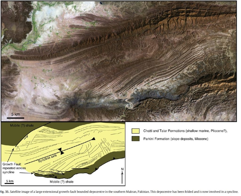
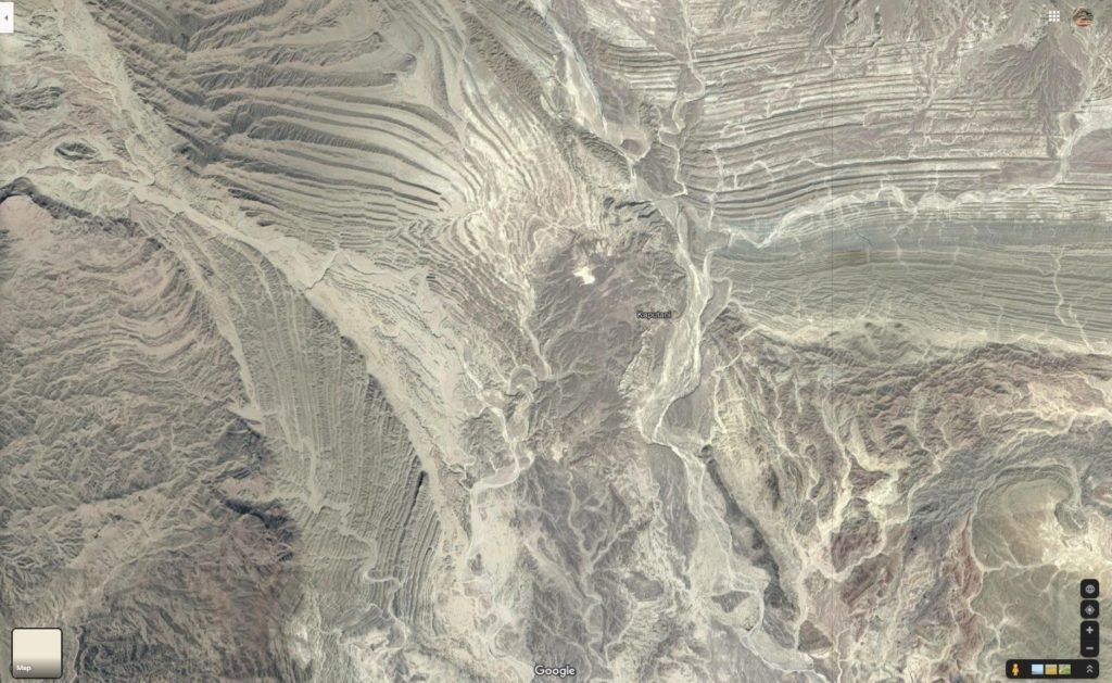
Fold-thrust belts developed in sedimentary rock sequences produce interesting and complex patterns on Earth’s surface. These patterns become even more complex and intriguing when the folded and faulted sedimentary layer sequence contains internal structures that pre-date thrust belt development. A particularly outstanding example of this effect is the Talar Syncline of the Makran fold-thrust belt, in which an extensional growth fault depocenter has been folded, uplifted, and exposed by erosion due to later compressional deformation (see Morley et al. (2011) linked below). The image below is Figure 35 from the Morley et al. paper, showing satellite image of the Talar Syncline along with a conceptual sketch (feature located at 25.458153N 62.205711E).
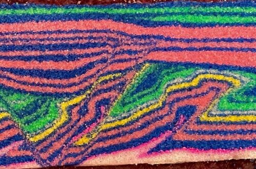
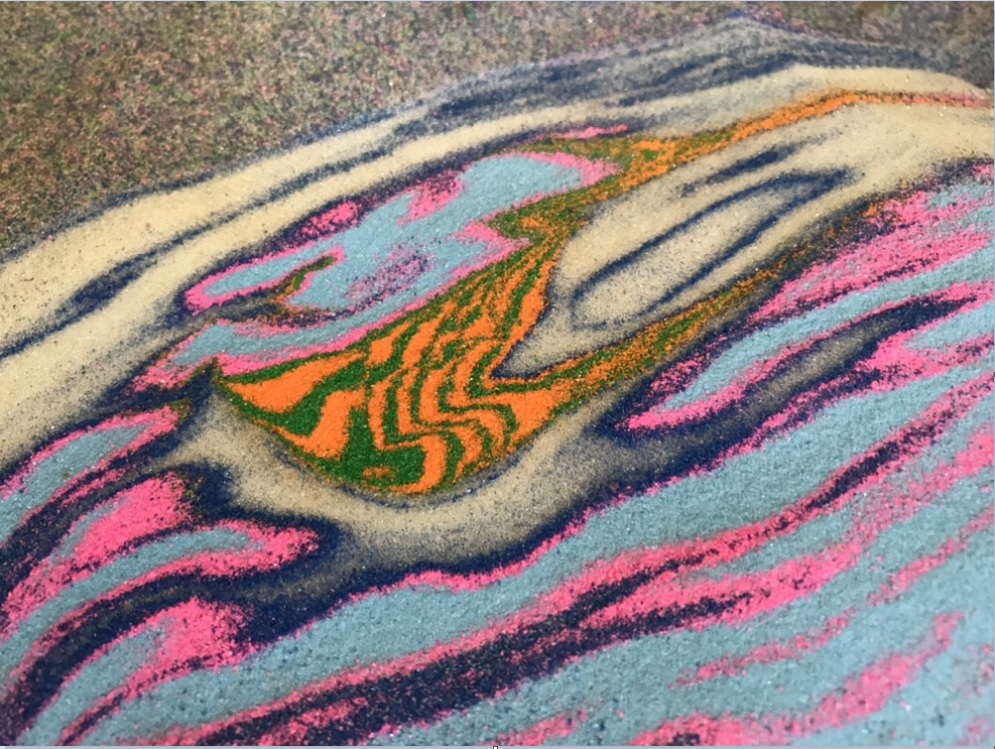
Despite being an incredible example of sedimentary basin and thrust belt process, the details of the Talar Syncline are still somewhat muted in satellite imagery. I tried to produce a sandbox model containing similar patterns highlighted by colored layering. The best model result, shown below. It is by no means a complete match, but it does contain an extensional growth fault-style depocenter deformed by later compressional forces, which bears resemblance to the real thing. Seeing the patterns in the colored model may make the patterns in the real-life, miles/kilometers-wide (and generally brown!) Talar Syncline more visible.

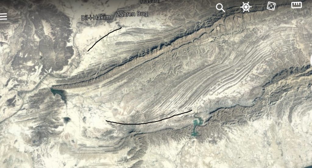
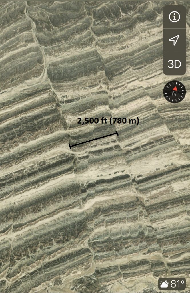
I first read about the Talar Syncline in Morley et al. (2011), and it has been subsequently described in greater detail in Back and Morley (2015), accessible in pre-print here. The Talar Syncline provides geologists a unique opportunity to examine the workings of growth faults and basin fill sediments that are typically buried well beneath Earth’s surface. A closer look at the satellite imagery reveals great exposure of the main growth fault along with several small normal faults offsetting beds within the large-scale syncline structure. The size of the syncline, and thus the scale of the depocenter itself before fold-thrust belt development, is impressive. Because the outcropping layers in the Talar are tilted and not vertical, outcrops widths exaggerate thickness slightly. Even so, everything is big and would be interesting to try to interpret from ground level without satellite imagery. The first image below shows duplexing along the main growth fault; the second is accommodation faulting to the northeast.
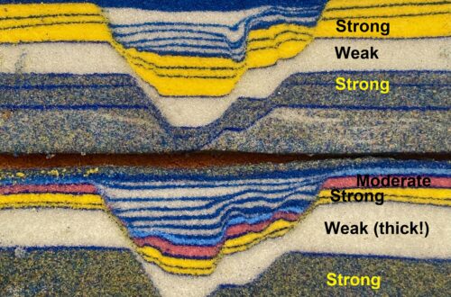
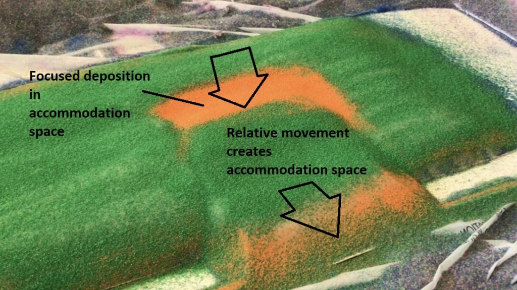
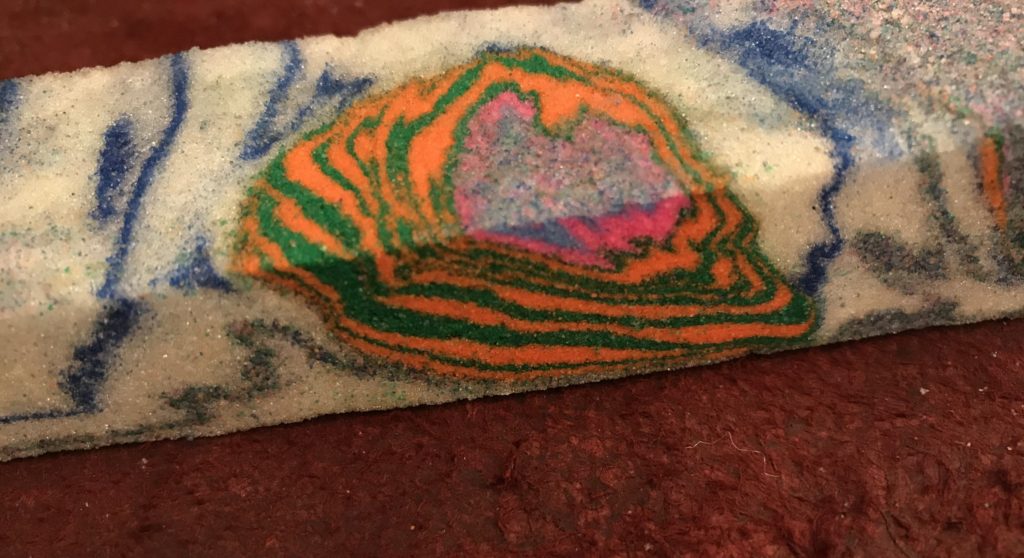
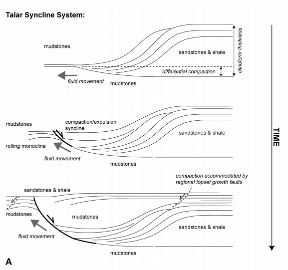
In simplest terms, the Talar Syncline represents a localized sedimentary depocenter folded by later compressional deformation. The model produces a similar structure by using two overlapping base plates, with the upper baseplate containing a cut-out area that will become the depocenter. The upper baseplate is moved relative to the lower baseplate, producing localized extension and accommodation space for more sediment layers. This becomes the locally thick accumulation of orange and green layers with the distinct internal pattern seen in the second image of this post.
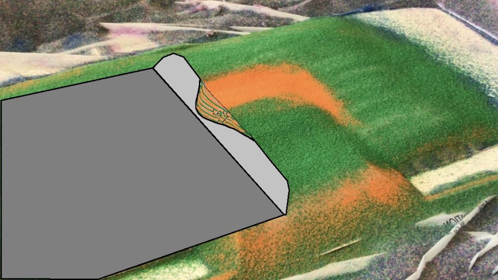
Prior to this movement, most of the layer pack is made of weak microbeads. With addition of frictionally stronger sand to the accommodation space within the microbeads, a depocenter floored by a downward-flattening extensional fault forms. Obviously no cross sectional view is available here, so I have sketched it below.
After deposition of fill, the depocenter is folded, tilted and uplifted during the subsequent shortening of the layer pack. Initial thrust movement of the depocenter is obvious during this phase. The image below shows a broad curve in the thrust front of the model resulting from detachment and early thrust ramp movement of the depocenter.

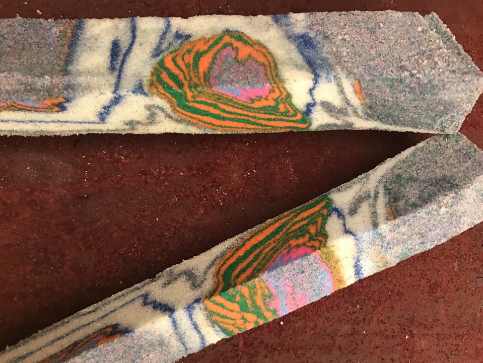
The model was eroded during shortening to counter thickening of the developing thrust wedge. The outlines of the depocenter gradually become visible as the model progresses towards its final appearance, as indicated by the black line in the first image below. The near-final pattern is obvious in the second image.


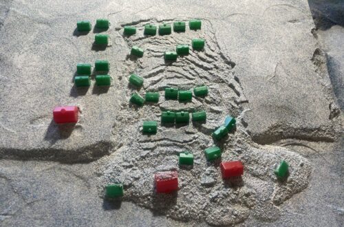
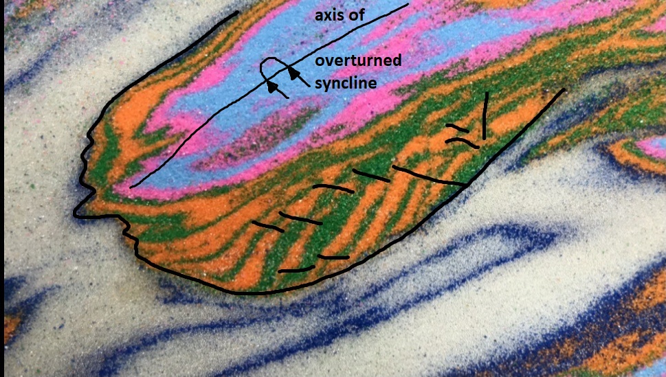
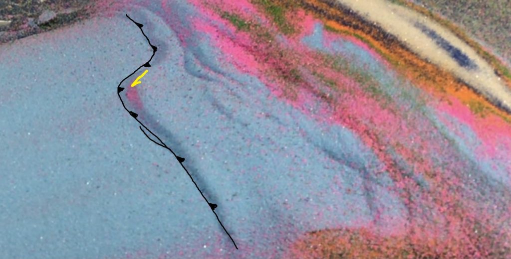
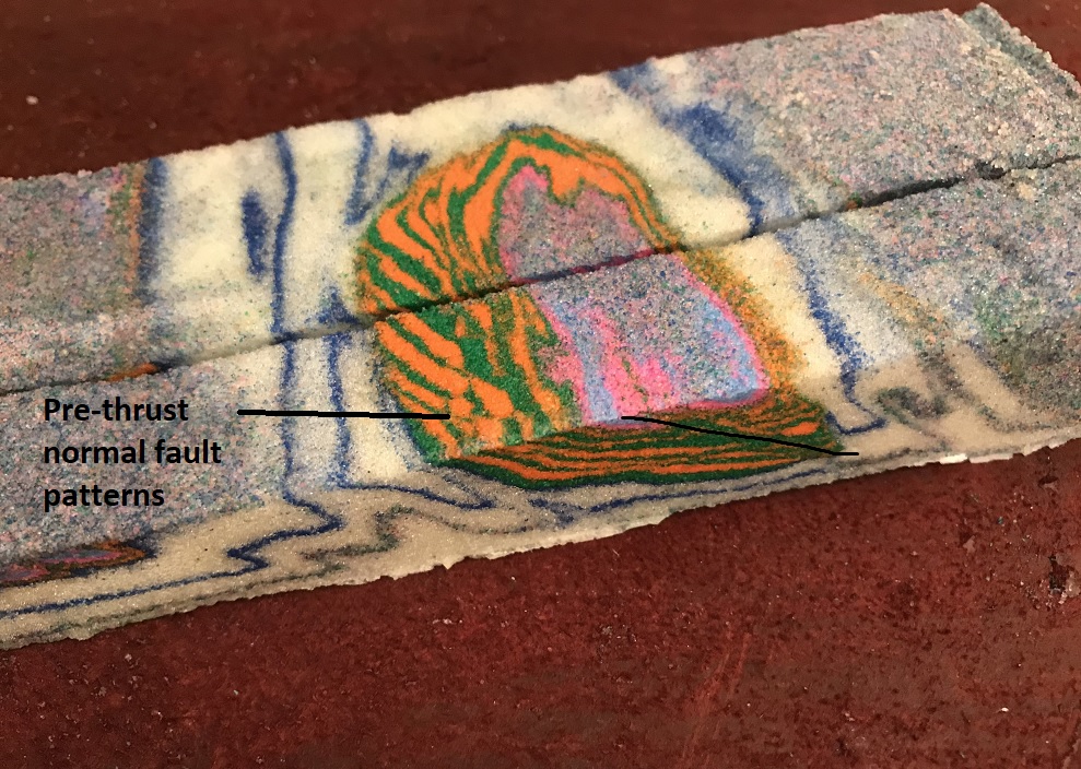
In cross section, the overturned synclinal structure of the depocenter is clearly visible. Away from the thickest part of the depocenter, the overturned back limb of the syncline is displaced along a minor thrust fault. The following images show a map view with extensional, pre-thrust faults and the synclinal axis marked, along with several cross-sectional images.
While the model produces a good visual for comparative purposes, it falls short of truly reproducing many details of the real Talar Syncline. The model requires movement of the baseplates to create the depocenter, while the real-life depocenter likely developed due to localized sediment loading atop mobile shale in a large river delta system. The sediment loading gradually pushed the shale out of the way, allowing more and more deltaic sediment to accumulate. This process is conceptually illustrated in Back and Morley (2015).
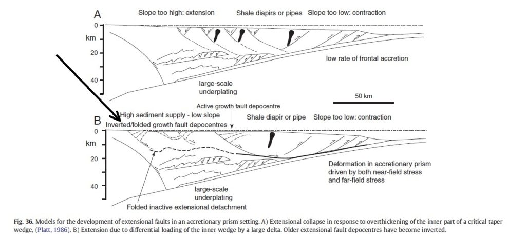
The real Talar Syncline is also much more symmetrical than the model, lacking the overturned back limb. Weaker materials and different ranges of mechanical contrasts would be necessary between the different layers to generate this structural style, and my granular materials just can’t do it. The image from Morley et al. (2011) below shows the position of the Talar and similar structures within the overall Makran Wedge (long arrow).
Despite these shortcomings, I was very pleased with the overall model outcome. Subtle changes to pre-depocenter layering, as well as in the layers used to fill the depocenter, resulted in different model outcomes. Two are shown below. In both, the thrusted depocenter is split by an anticline, visible as a dark blue elliptical outcrop ring. The depocenter in the lower image contained weak microbeads itself, and underwent more internal faulting during thrusting. As a result, its overall pattern is less recognizable.

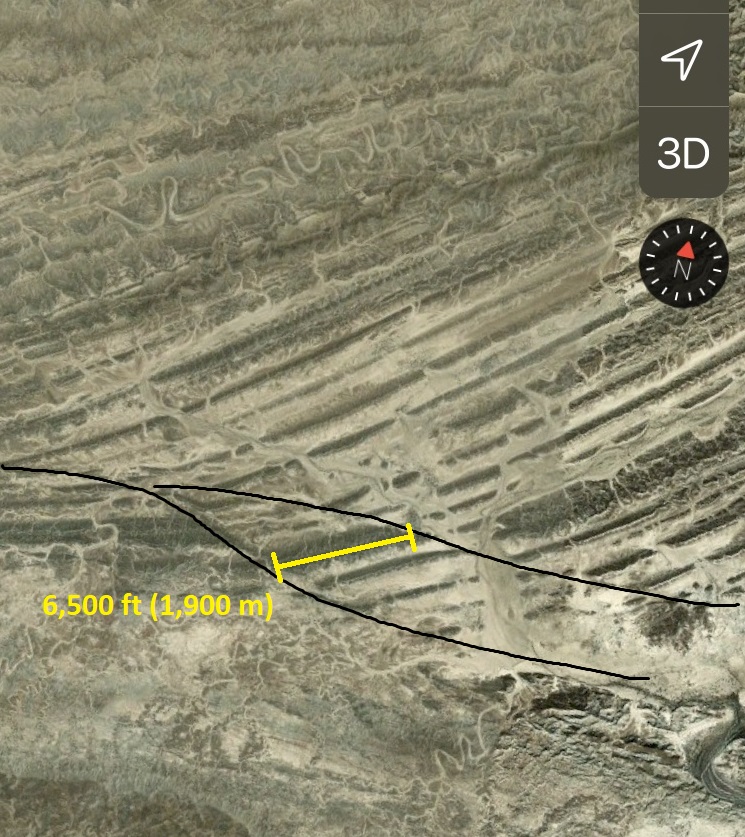
The Talar Syncline is an extreme example of pre-thrust belt sedimentary structures creating unique outcrop patterns, but I am sure it is not alone. Numerous other unusual outcrop patterns exist in this part of the Makran, presumably due to a similar set of formative processes. In the satellite image below, sets of sedimentary layers meet each other at a variety of angles. None of these relationships are consistent with thrust faulting and compressional folding of an orderly, parallel, and uniformly thick package of sedimentary layers. The pattern visible just left of center is particularly well defined (25.947933N, 59.288584E).
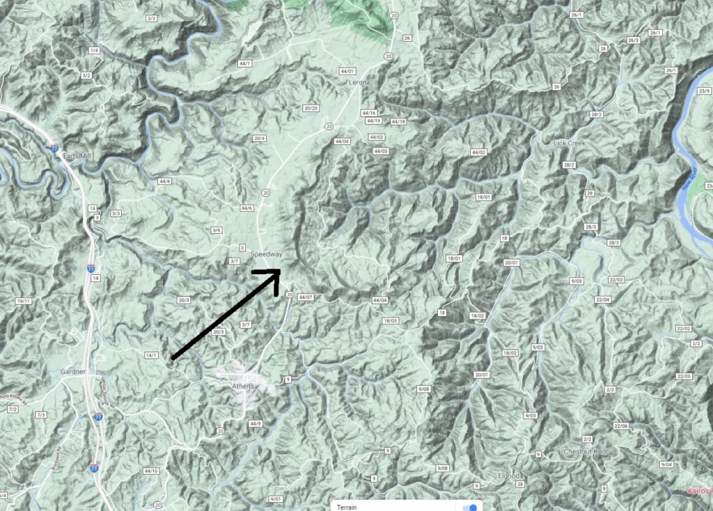
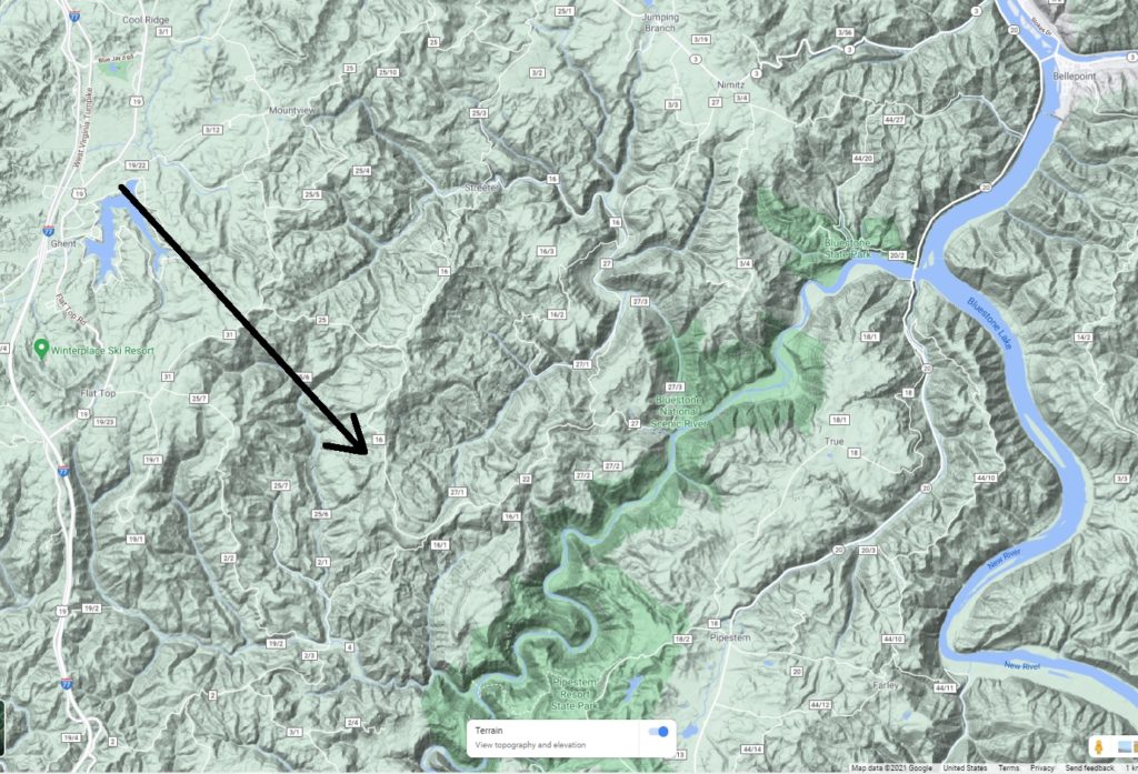
I have always wondered if similar features exist anywhere in the Appalachian fold-thrust belt, particularly in parts of the Mississippian section in eastern West Virginia. Rock type control over topography in sedimentary Appalachia is extreme, so a Talar-like feature should be quite visible if it exists. No such feature is apparent to me anywhere in the sedimentary Appalachians, but a number of unusually rounded and curved drainage and ridge patterns are visible in parts of West Virginia. Perhaps these are expression of pre-fold and thrust depositional structures? Both of the images below are from southeast West Virginia, near the confluence of the Bluestone and New Rivers. The curving ridges indicated by the arrows are a bit unusual within the area. They are located in a broadly anticlinal area, but their curvature and relationship to neighboring topography are not consistent with a solely compressional origin.