Lidar hillshade imagery hints at the location of a future coal spoil landslide
by Philip S. Prince
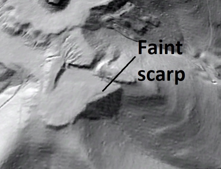
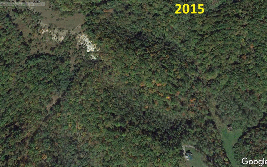
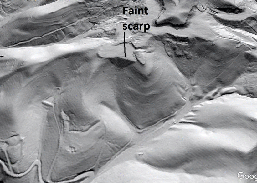
A coal spoil landslide in southeastern Wise County, Virginia, appears traceable to a faint scarp visible in the spoil pile in a 2017 lidar dataset. The slide pre-dates October 2019 Google Earth imagery and post-dates the 2017 lidar data acquisition. In the image below, the flat-topped spoil pile where the slide originated is readily visible near the center of the image. The “hairline” arcuate scarp is faintly visible at its edge; it is labeled in one frame of the GIF that follows, which also shows the slide (regional location and context are at the end of the post).
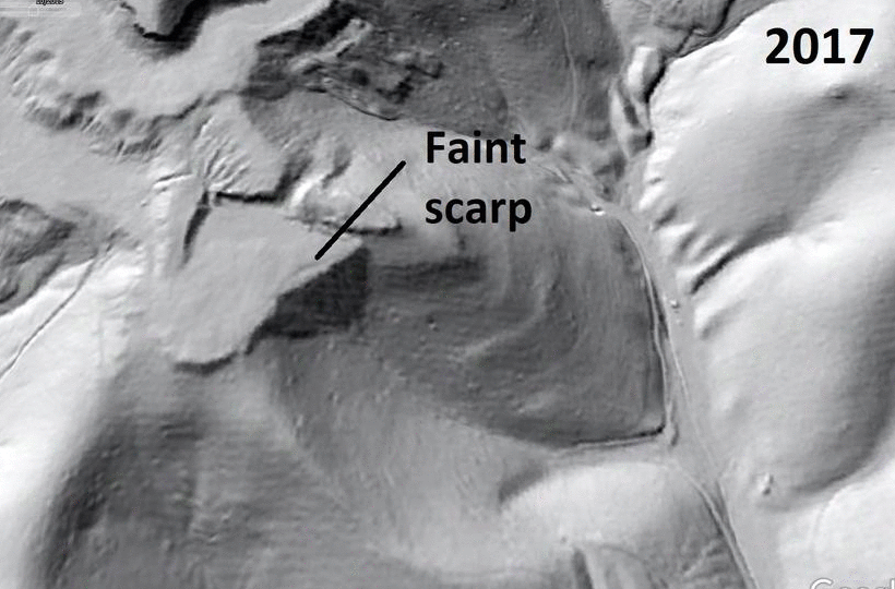
I first noticed the (very) faint scarp in 2018 while checking out lidar hillshade imagery of the Guest River Gorge to the west. Coal spoil landslides in the area turned out to be more eye-catching, which led me to look around for evidence of incipient failures. The flat top and ravine-fill location of the spoil that sourced the recent slide caught my attention, leading me to notice the scarp. Zooming in on the feature does not necessarily make it more visible, as it pushes the limits of resolution of the 1-meter lidar dataset.
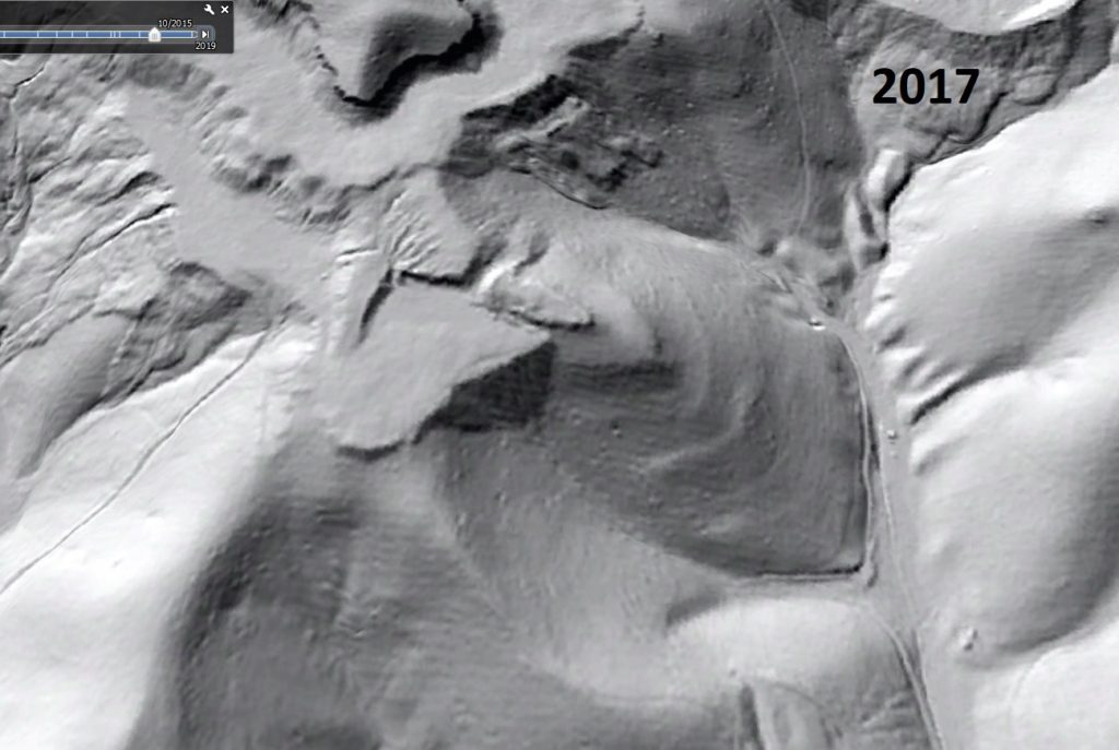
Today (Nov. 30, 2020), I decided to look at Google Earth imagery to check for any change at the location, and was not entirely surprised to see a slide had occurred at the scarp’s location. The GIF below shows 2015 imagery, the 2017 lidar overlay, and the October 2019 imagery showing the slide.
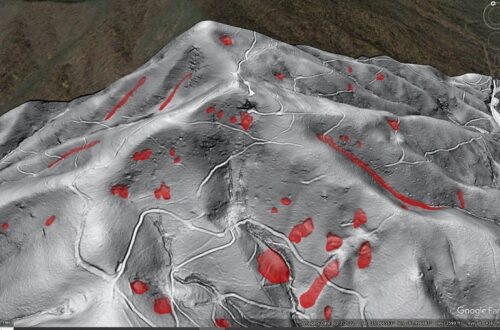
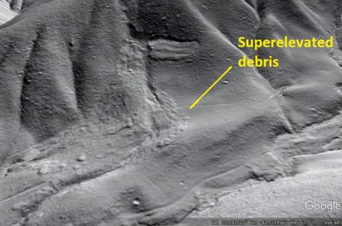
From its headscarp/initiation zone (IZ) to its downslope terminus, the slide extends over a ground length of ~830 ft (~250 m). The slide appears to have progressed to a flow and followed the ravine downslope, passing to the north of a house situated above the ravine. Several downed pine trees with green needles are visible near the headscarp/IZ, suggesting the slide probably occurred in 2019. Tree fall patterns indicate a partially intact block may be present near the head of the slide, with the downslope flow component knocking trees down in a uniformly downhill direction.
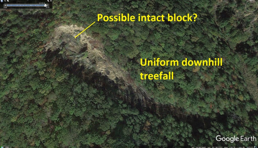
The perspective view below shows the path of the slide/flow down the ravine.
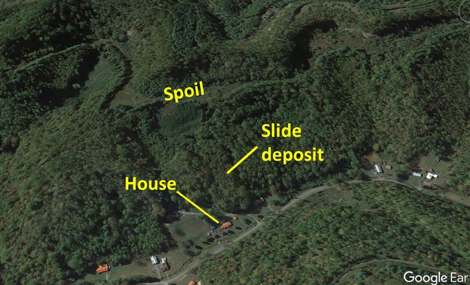
To the north of this location, another coal spoil slide is visible in close proximity to a house. I am unsure of the relative timing of the slide and house construction, and the vegetation suggests the slide is many years old but younger than the forest growth around it. The GIF below shows subtle distinctions in vegetation atop the slide and in the surrounding forest. While these coal spoil landslides are modest in physical scale, they are large enough to significantly impact home sites as well as roadways which may offer the only access to portions of this rugged landscape.
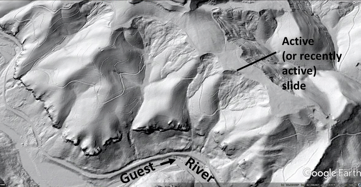
To the west along the Guest River, extensive failures are visible along spoil piles developed on a ridge crest. One failure is active or recently active, with sliding beginning between 2012 and 2015. Google Earth imagery suggests some movement may still be occurring, as bare earth is visible on a slide feature in the GIF below.
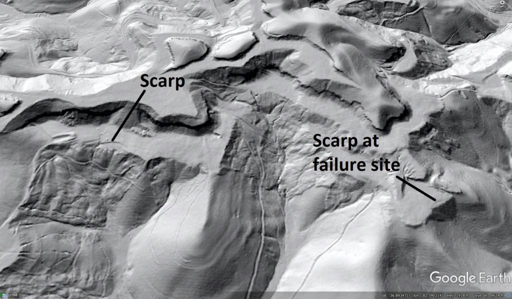
In addition to the scarp associated with the 2019(?) slide, a similar but larger scarp immediately to the west is more visible in lidar hillshade imagery but has yet to produce a failure.
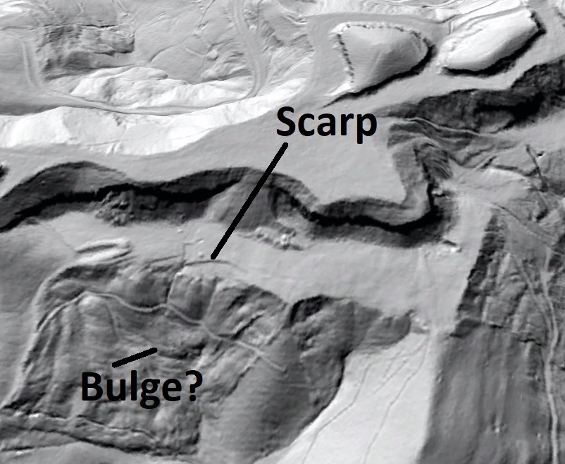
Closer inspection of this slightly larger scarp suggests the slope may be bulging below it, but this is speculative in the absence of field work. Fortunately, the ravine below this scarp is completely uninhabited.
The scarp-to-slide progression visible in the lidar and Google Earth imagery is an interesting example of how detailed lidar data and regularly updated land surface imagery can be used to understand landscape change over short timescales. Due to the extensive forest cover in the region (even in reclaimed mining areas), relevant features indicating imminent or ongoing ground movement can be nearly impossible to see from the air or even on the ground. Using lidar to “see through the trees” greatly enhances the ability of geologists and engineers to identify and address land stability issues in an efficient manner.
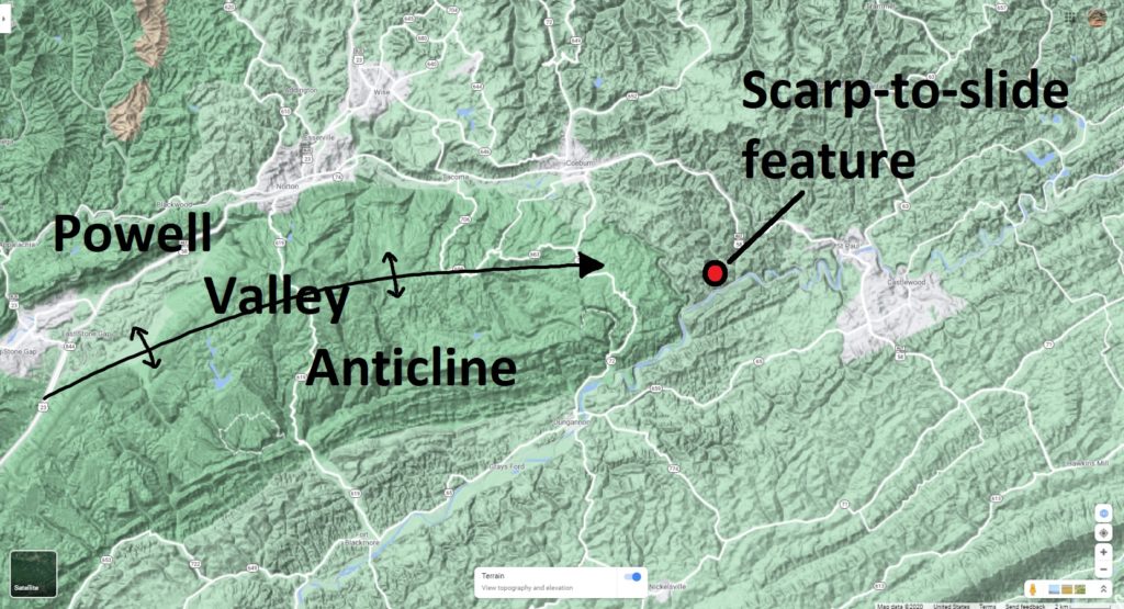
These Wise County coal spoil slides are located on the northeastern plunge-out of the Powell Valley Anticline, a prominent ramp anticline structure near the leading edge of the Appalachian sedimentary fold-thrust belt. Coal measures in this part of Wise County occur in Pennsylvanian-aged strata, which have been extensively mined throughout the area. The scarp-to-slide feature is located at 36.891774N 82.390019W.


You May Also Like
Lidar imagery reveals details of debris flow movement in the eastern Blue Ridge Mountains of North Carolina
Lidar reveals geologic details of the “worst” coal mine in the Valley of Virginia