Interesting “sideways” movement of a large sandstone blockslide
Philip S. Prince
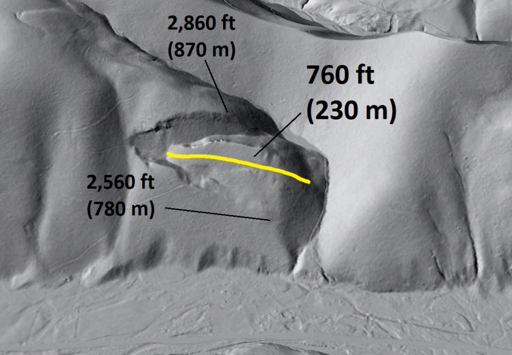
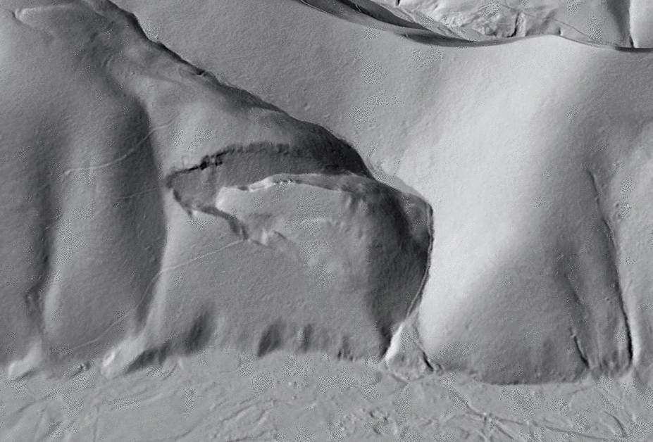
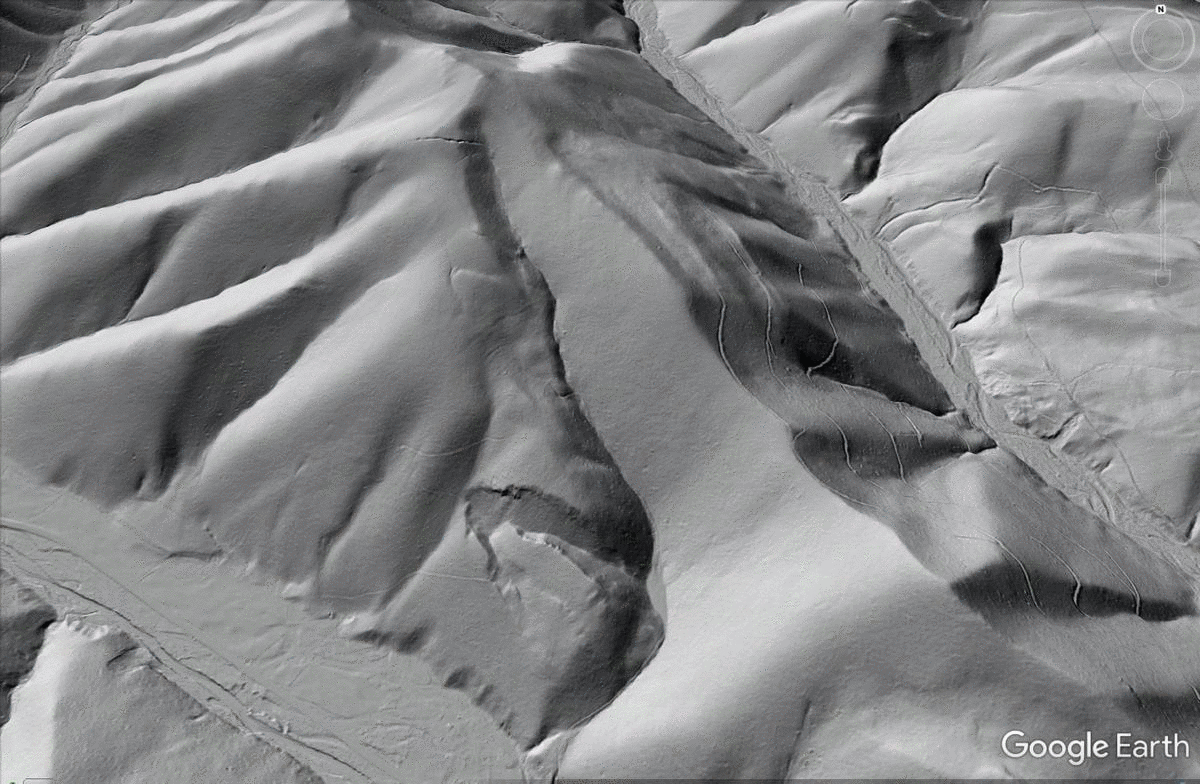
A large sandstone blockslide in Highland County, Virginia presents an unusual appearance in LiDAR hillshade imagery–it appears to have moved sideways across a slope instead of directly down the slope. The slide is entirely concealed by forest cover. It is located at 38.297776N 79.763373W.
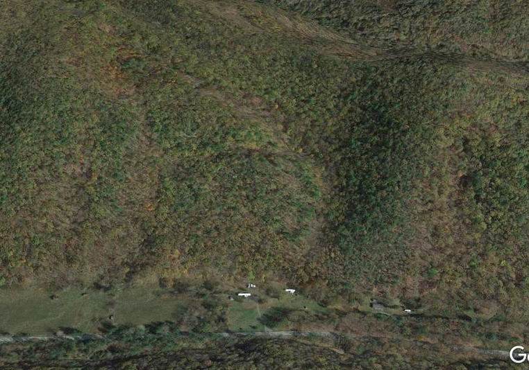
The slide has occurred in the thick sandstone sequences of the Foreknobs Formation, whose shale interbeds may have contributed to this failure. The white mobile homes visible at the base of the slope in the GIF above give a sense of the scale of the slide, which is about 760 feet (230 m) long. The upslope scarp is about 300 feet (90 m) above the lower right toe of the slide.
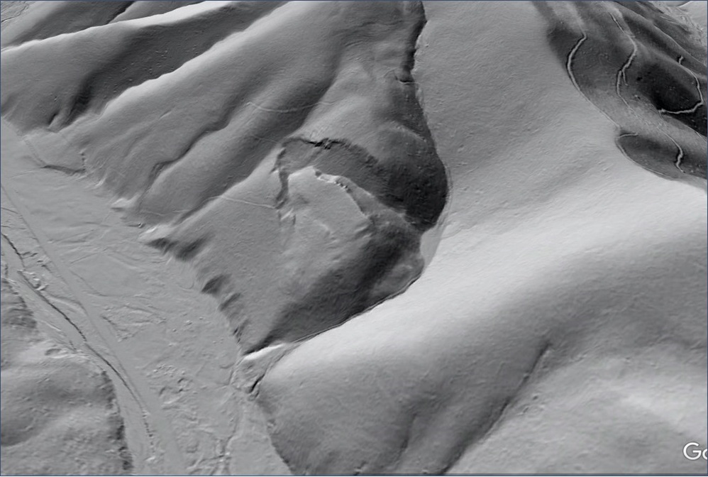
A rotated Google Earth view shows that movement of the slide was indeed oblique to the most direct downslope path, with the slide mass traveling down an inclined plane into the steep stream valley towards the observer.
The slide could be regarded as a wedge failure, with the intersecting failure planes appropriately oriented to allow the slide block to travel towards the open stream valley.
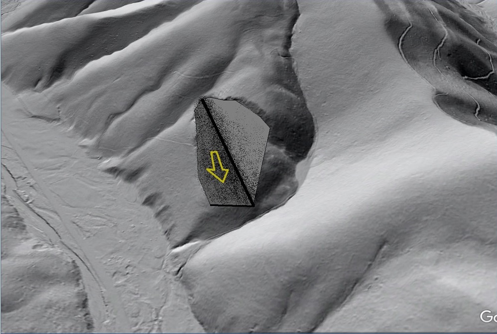
The narrower downslope failure plane likely dips back into the slope to prevent the slide mass from spilling out and taking the steeper path towards the large valley at left in the image. Movement is thus obliquely downslope, with the slide mass “cradled” by the intersecting surfaces to keep it on its atypical path.
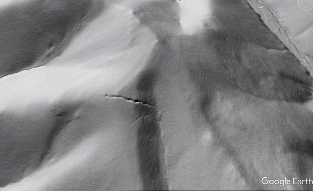
Movement of the slide has destabilized upslope areas of the mountainside, where cracking is visible in the hillshade imagery. The first set of cracks upslope of the slide show the same orientation as the slide’s scarps. They are highlighted in yellow in the GIF below; its resolution should support zooming in.
The uppermost set of cracks near the mountaintop, shown below, appears to be open fractures that may collect surface drainage. The cracks are 2,100 ft (640 m) ground distance from the upslope scarp of the slide, and 500 ft (150 m) above it. The crack system is 370 feet (113 m) long.
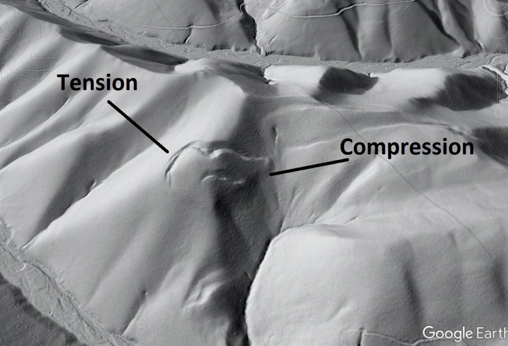
While the “sideways slide” is definitely one-of-a-kind in this region, another slide to the north appears to show the early stages of similar but less dramatic oblique movement. It is circled in yellow below, and is just under 1 mile (1.6 km) from the sideways slide.
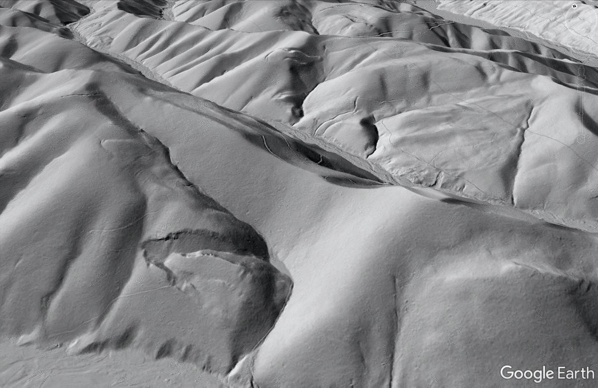
This slide occurs in the same bedrock units and may share enough structural characteristics to fail under similar circumstances. Both the left and upslope scarps show extension, with compression occurring along the right edge of the slide to produce an overall clockwise rotation.
The sideways slide and its neighbors show the significance of weak and specifically-oriented releasing surfaces in controlling slope failures in the Valley and Ridge, particularly where large, strong sandstone sections are involved. The Foreknobs Formation hosts numerous huge blockslides, some of which were highlighted in this post and this post. As with the sideways slide, these features are nearly invisible without LiDAR-derived imagery and have previously escaped detection!